MERAVIGLIOSO URBANO

bike and pedestrian network

MERAVIGLIOSO URBANO

bike and pedestrian network | Putignano (BA) | 2022
second phase


#strategy #bikemobility #pedestrianmobility #publicspace #urbandesign #integratedsystem #urbanregeneration #masterplan #streetfurniture #urbansquare #playground

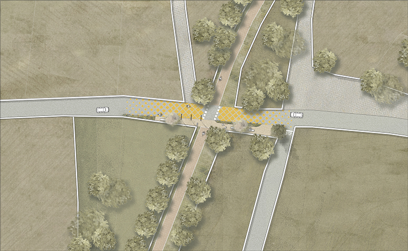
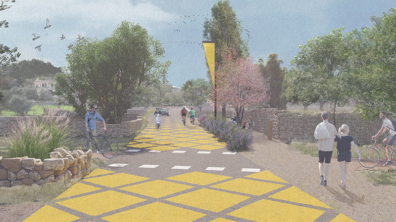
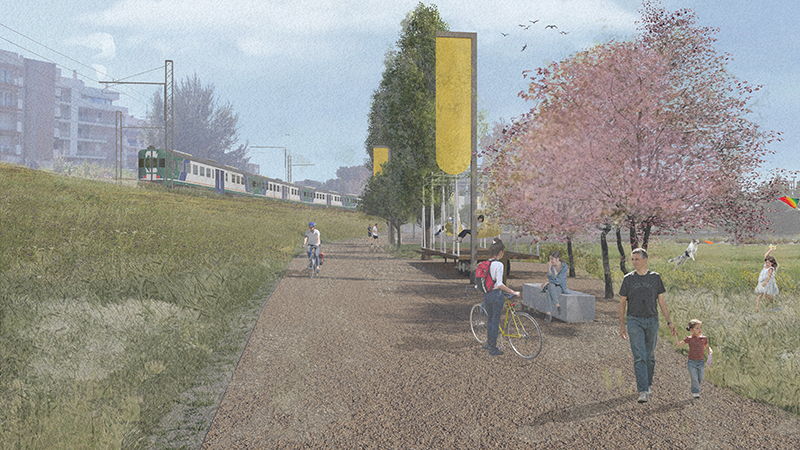
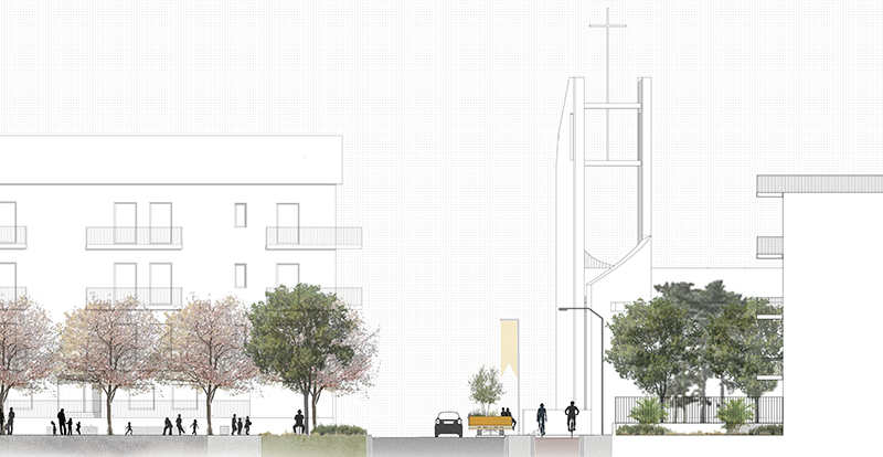
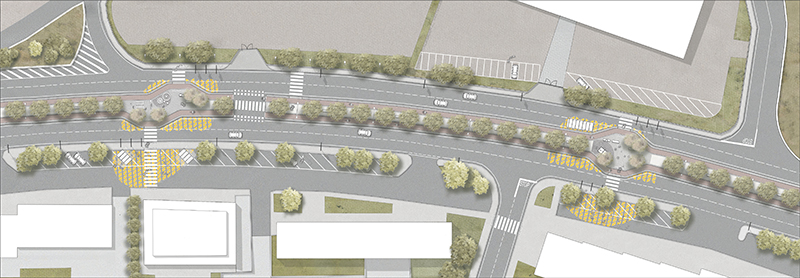
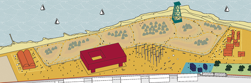
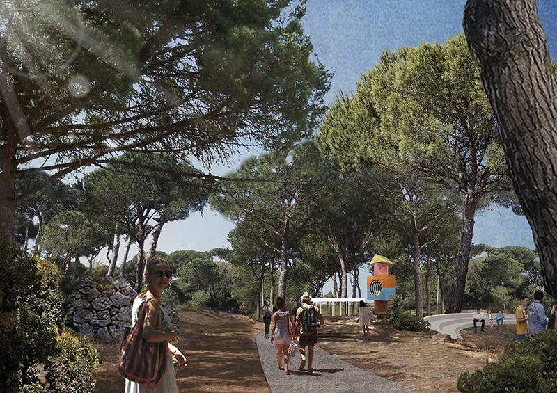
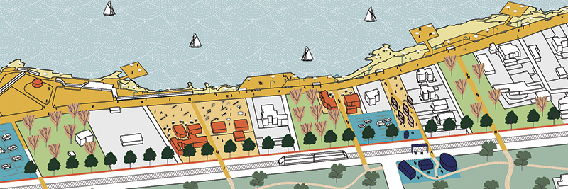
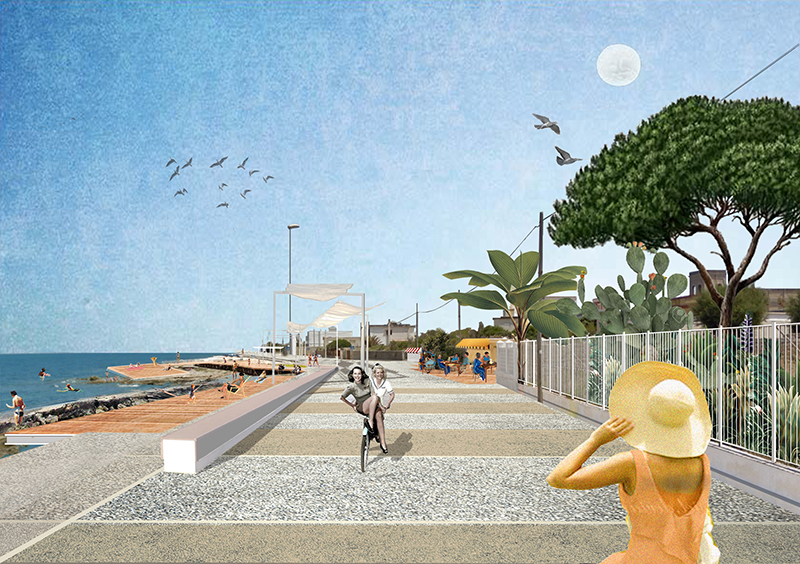
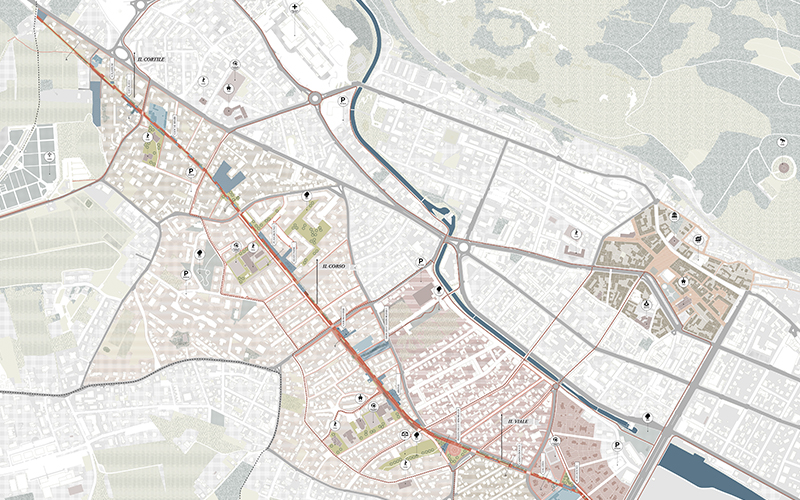
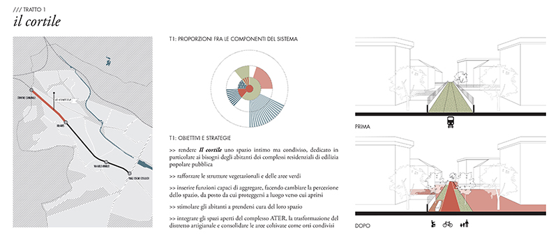
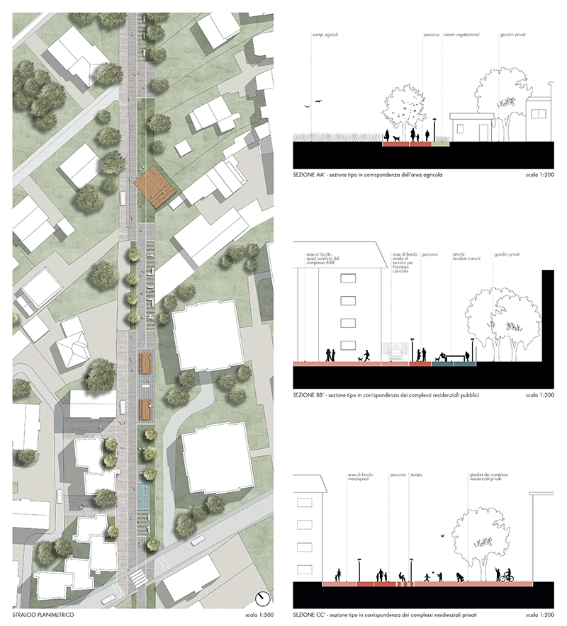
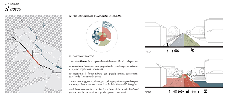
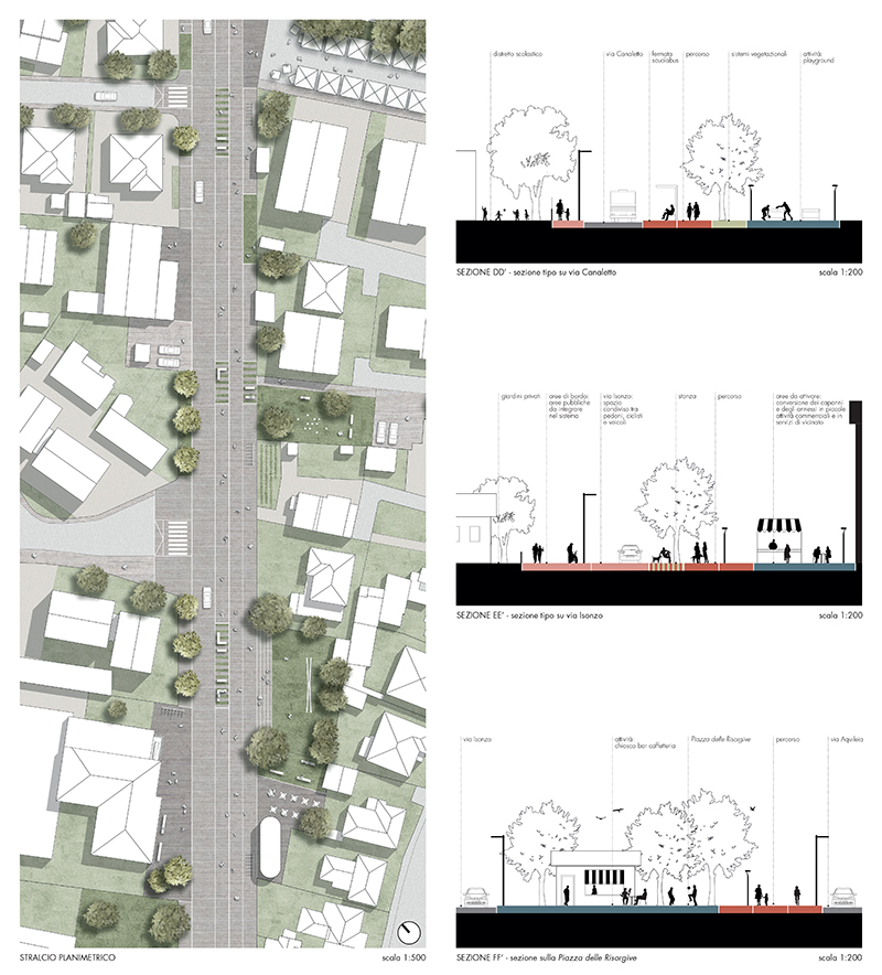
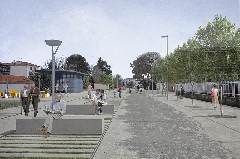
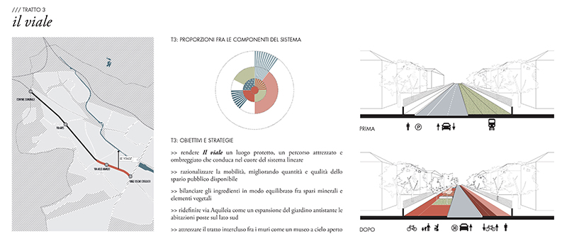
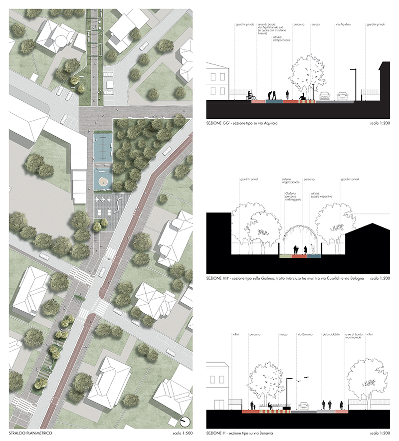
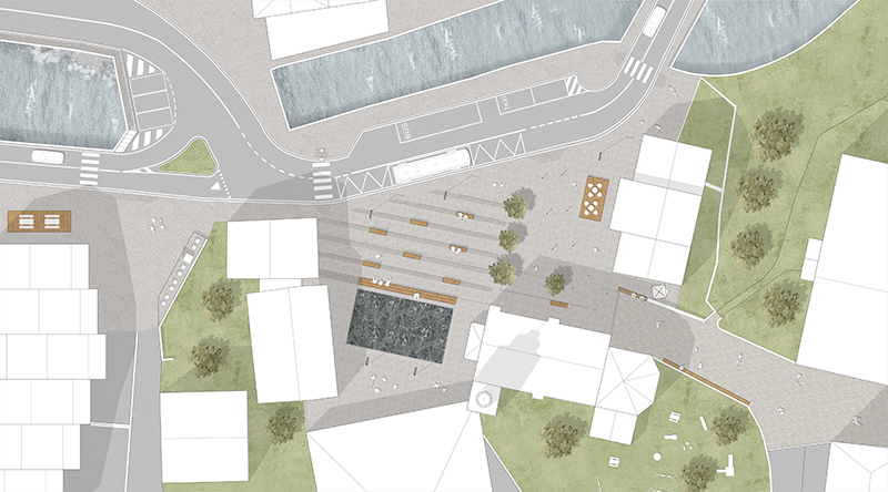
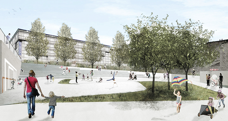
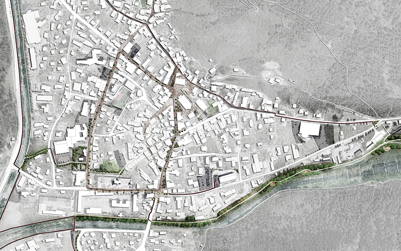
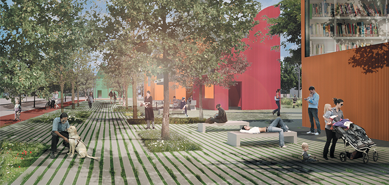
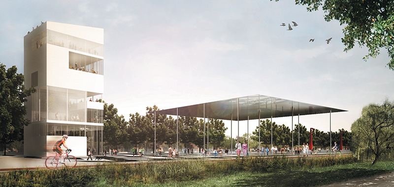
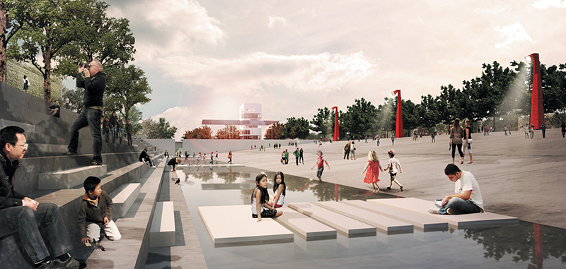
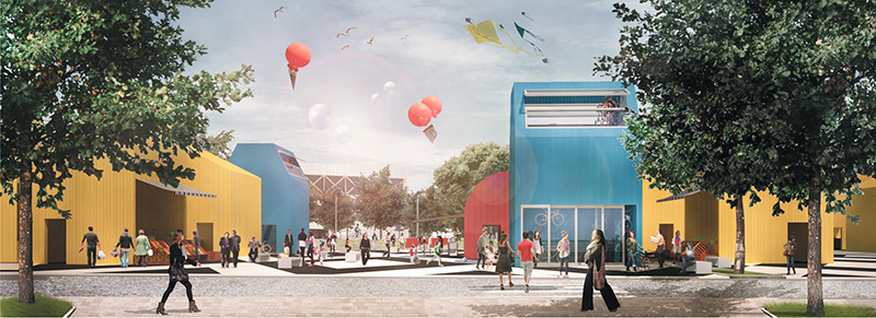
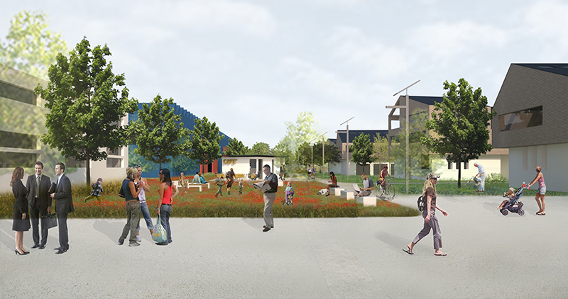
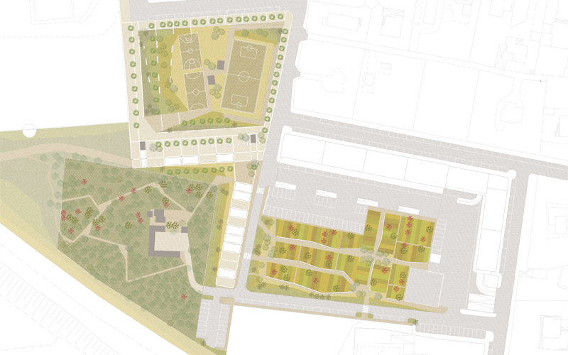
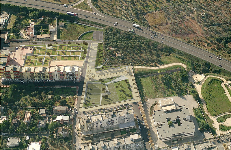
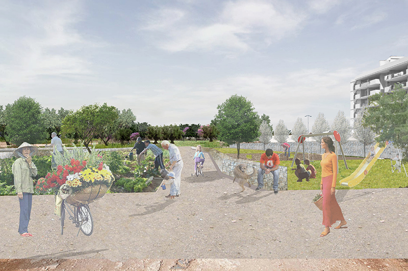
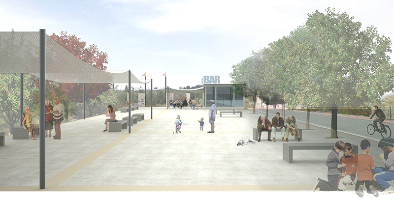
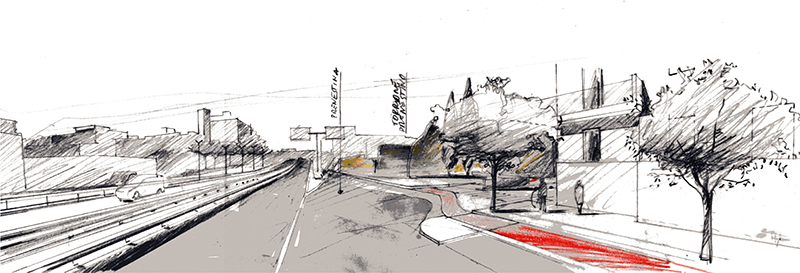
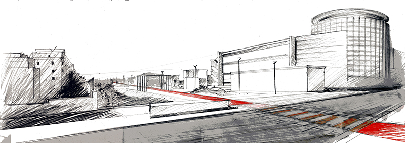
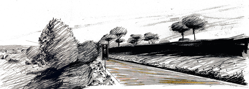
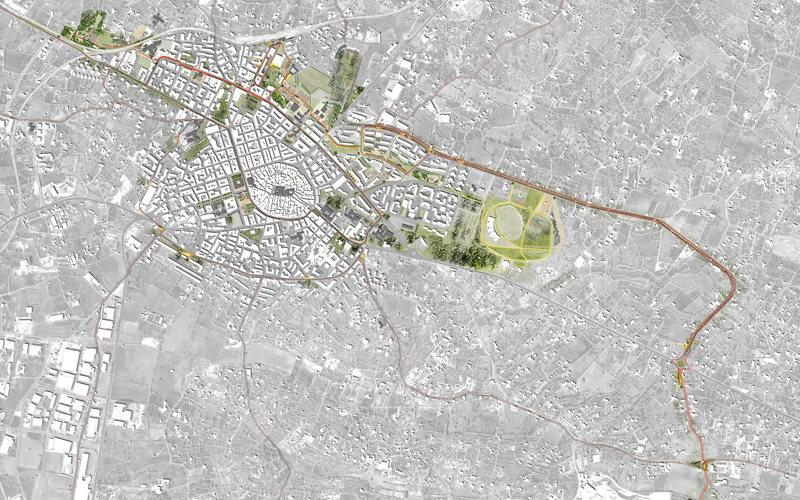
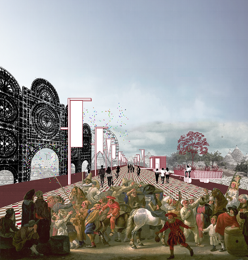
La visione che si propone per l’area di intervento, nel quadro di una struttura generale a livello urbano, è quella di attivare un sistema continuo di spazi aperti, pubblici e condivisi incardinato sulla mobilità lenta e sui sistemi naturali. Dunque, non una linea, ma uno spazio: un luogo accentratore, dotato di sue proprie caratteristiche, per il quale si prevede una densità urbana di funzioni, di attività, di socialità, di scambio, capace di ristabilire e rigenerare un’identità comunitaria e condivisa.

+

La strategia progettuale persegue alcuni specifici obiettivi:

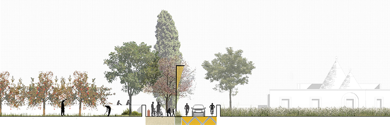
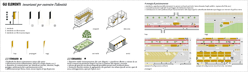
– definire lo spazio e la sua identità, chiara e riconoscibile, qualificata da specifici caratteri fisici e percettivi e dalla ripetizione di alcuni elementi iconici (stendardi e coriandoli);

– connettere i punti nevralgici (rete di mobilità territoriale e locale) in un sistema continuo capace di soddisfare l’uso quotidiano e quello saltuario;

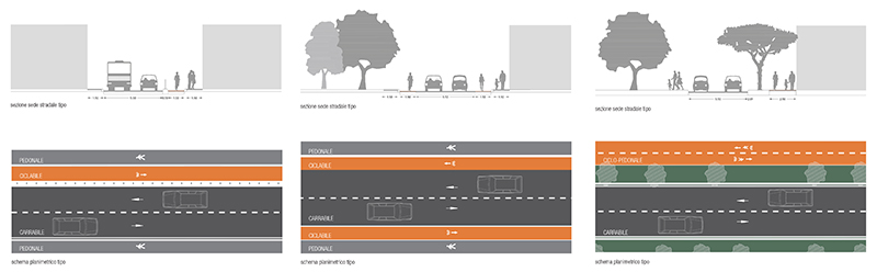
– rispondere alle necessità del contesto attraverso tre tipi di percorsi diversi (il loop, le propaggini, i raggi) che si declinano rispetto all’essenza dei luoghi;

– lavorare con l’effimero (usi temporanei e urbanismo tattico) per sperimentare le trasformazioni urbane nelle aree incerte e indeterminate (le Città e il Parco) e per arrivare progressivamente alle soluzioni definitive, attraverso un processo evolutivo nel tempo;

– integrare l’esistente, muovendosi in modo strategico, stabilendo delle priorità e gettando le basi che predispongano il completamento del sistema in fasi successive.


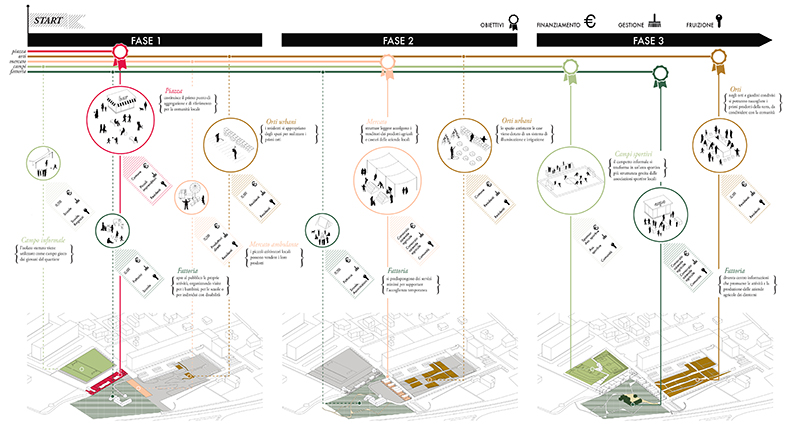
Con ben saldi questi obiettivi, è stata sviluppata la strategia proposta, che si struttura come un intervento metodologico verificato operativamente nelle aree oggetto di concorso. Il progetto prefigura infatti una visione più ampia, ma più incisiva e performativa sul territorio. Pertanto si è scelto di operare in maniera strategica, organizzando la trasformazione in fasi e strutturando una strategia di sviluppo che sia, da un lato, capace di assorbire modalità alternative per la realizzazione, gestione e manutenzione dei beni collettivi, includendo i diversi soggetti, pubblici e privati, che si occupano di trasformazioni spaziali e, dall’altro, sia sufficientemente flessibile per rispondere ad esigenze, occasioni e necessità, per loro natura mutevoli nel tempo.
CREDITS

type: restricted design competition
result: second phase
client: City of Putignano
consultant: Valerio Tufoni (geology), Kristian Sesto (safety management)
BARI COSTA SUD

redevelopment of the coastal area

BARI COSTA SUD

redevelopment of the coastal area | Bari | 2018


#urbanregeneration #bikemobility #pedestrianmobility #publicspace #urbandesign #masterplan

+

CINQUE AZIONI PER LA COSTA SUD

  1. riconoscere la discontinuità come valore

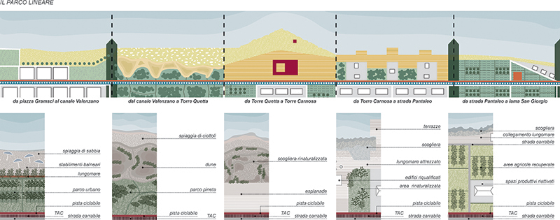
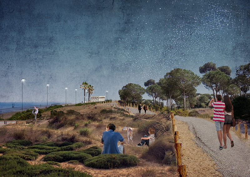
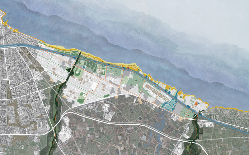
L’area di progetto è caratterizzata da un paesaggio frammentato, la cui identità non è univoca. Fino al canale Valenzano, si riconosce una forma della città, definita da espansioni concentriche: qui è sufficiente il riammagliamento con la città storica attraverso mirati completamenti della rete stradale e dei tessuti edilizi. Oltre la lama, la pianificazione dell’ultimo secolo ha generato un tessuto discontinuo, costituito da un sistema di isole indipendenti ed eterogenee. Riconoscendo la discontinuità del costruito come un valore da preservare, il progetto rafforza la natura dei diversi ambiti come realtà autonome ed indipendenti, da densificare e ridefinire nei caratteri e nei bordi. Il vuoto, nella forma di parco lineare, sarà l’elemento strutturante, capace di tenere insieme le diversità e ridefinire l’identità del luogo. 

  1. strutturare la spina dorsale

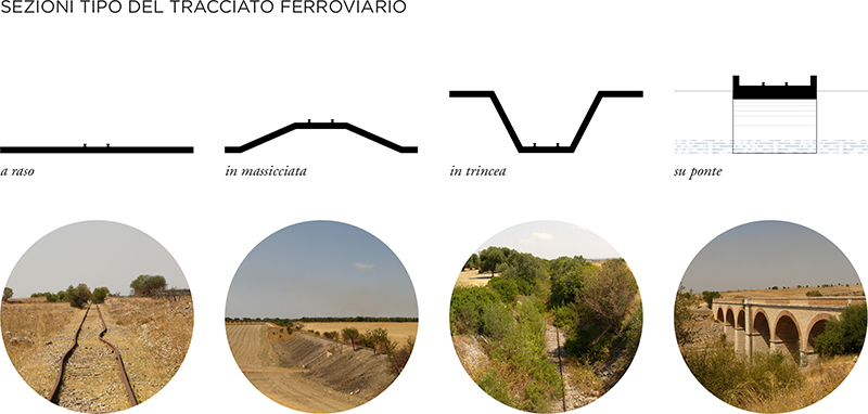
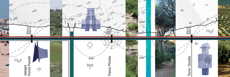
Affinché la discontinuità non significhi segregazione e marginalizzazione, occorre garantire condizioni ottimali di accessibilità. La proposta consiste nel trasformare il tracciato ferroviario, fino ad oggi una cesura invalicabile nel territorio, nella spina dorsale capace di strutturare la trasformazione, convertendolo nel TAC (Tram dell’Arte Costiera), un’importante asse di trasporto pubblico locale da relazionare ad un sistema capillare di mobilità ciclopedonale, che possa costituire realmente un’alternativa alla mobilità su gomma.

  1. individuare i poli

Il sistema lineare della mobilità pubblica è potenzialmente un sistema omogeneo. Il rafforzamento dei nodi esistenti e l’inserimento di nuovi poli accentratori lungo il suo percorso permette di costruire dei momenti che si configurano come delle pause di differente scala, condensatori di vita e di vitalità. I poli lungo la linea del TAC, alcuni già esistenti, altri di nuova costituzione (il parco marittimo, il polo di Torre Carnosa, dell’insediamento costiero di San Giorgio, il distretto agro-marittimo), sono di diverso tipo e rilevanza. La trasformazione è direzionata, da un lato, verso funzioni capaci di costituire attrazione per la scala territoriale e, dall’altro, verso lo sviluppo di un sistema continuo di spazi comunitari per la cultura, l’educazione, lo sport e il leisure, capaci di costituire attrazione e identità alla scala locale. 

  1. lavorare sui bordi

Questa parte di città, per sua natura, si è sviluppata all’interno di fasce longitudinali, parallele alla costa e delimitate dalle linee infrastrutturali, con scarsi punti di contatto e connessione trasversale. La sfida consiste nel rileggere queste fasce, reinterpretando il concetto di limite non come cesura, ma come territorio di mediazione fra le parti. Nel progetto le aree di bordo assumono quindi un valore particolare, sia come punto di incontro che filtra realtà diverse (paesaggio costiero e retrocostiero, tessuti insediativi, sistemi naturali), sia luoghi ben definiti, dotati di una propria identità, che hanno la possibilità di diventare per il territorio una risorsa eccezionale perché specifica del luogo.

  1. evitare il consumo di suolo: riusare, liberare, densificare, intensificare

Il momento di crisi attuale non permette errori, né sprechi. Serve agire in maniera strategica, traendo il massimo beneficio dalle risorse già disponibili. Pertanto il progetto si fonda su quattro principi. Riusare l’esistente (edifici dismessi e spazi scarsamente definiti), prevedendo anche ri-attivazioni temporanee per innescare le prime trasformazioni. Liberare il fronte mare e l’ambito retrodunale da tutti quegli elementi incongrui che, se non possono essere riutilizzati, dovranno essere demoliti. Densificare, completando i tessuti esistenti, così da preservare il vuoto, naturale o minerale, come elemento di riconnessione fra le parti. Intensificare di funzioni e attività, puntando sulla mixitè funzionale, tipologica, formale.

CREDITS

type: ideas competition
client: Comune di Bari
urbanism: arch. Mauro Baioni

FRONTE/RETRO

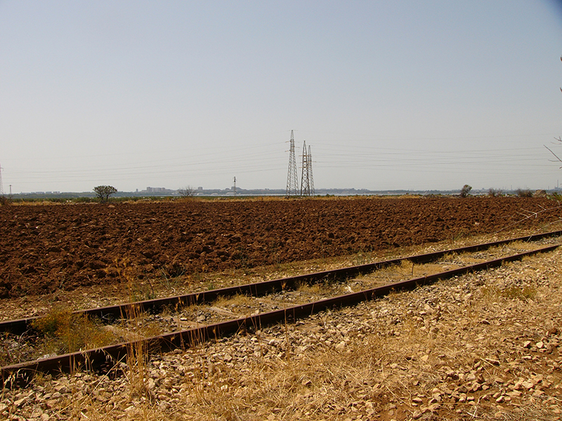
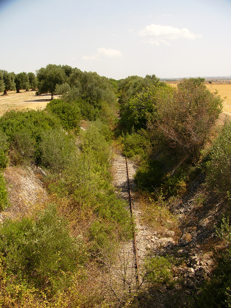
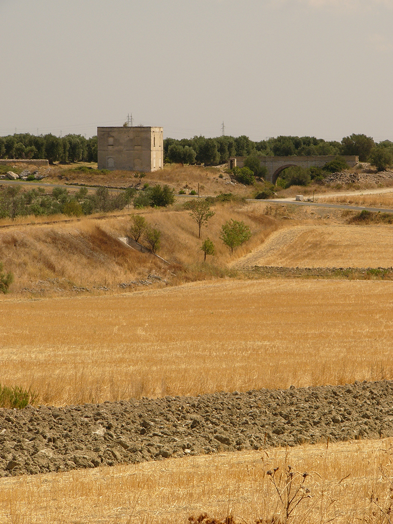
linear park on the ex-railway of Fincantieri

FRONTE/RETRO

linear park on the ex-railway of Fincantieri | Monfalcone (GO) | 2018


#infrastructure #park #bikemobility #pedestrianmobility #strategy #masterplan

Lorem ipsum dolor sit amet, consectetur adipiscing elit. Praesent nisi tellus, posuere quis auctor tincidunt, laoreet ut orci. Pellentesque interdum scelerisque venenatis. Fusce id dui at metus vestibulum convallis id id dui. Curabitur nisi nisl, porta eu elementum nec, vehicula eu tellus. Pellentesque in blandit mi. Nullam non justo orci. Sed bibendum ornare scelerisque. Duis blandit a felis ut molestie. Morbi facilisis nisi eros, consequat suscipit ante vestibulum nec. Aenean vestibulum enim ac nulla maximus, ac blandit turpis fringilla. Suspendisse eu nulla lorem. Sed egestas laoreet laoreet.

+

Etiam ante ante, dapibus lobortis eros mollis, dictum aliquam lacus. Ut in neque vitae tellus pulvinar mattis. Aliquam feugiat arcu ac sapien venenatis, facilisis ultrices ipsum tristique. Mauris rutrum mi venenatis ultrices facilisis. Donec a tortor semper, fringilla augue sit amet, dictum turpis. Suspendisse semper orci quis porta mollis. Fusce imperdiet mi sed nisl pulvinar bibendum. Nam non rhoncus enim, quis blandit turpis. Quisque vel turpis ut lacus imperdiet euismod. Cras iaculis ante dolor, vitae porttitor felis maximus at. Ut varius enim vitae nisi pulvinar placerat. Nullam cursus ultrices pellentesque.

CREDITS

type: ideas competition
cliente: local municipality

THE COLLABORATIVE MILE

urban regeneration of an access road

THE COLLABORATIVE MILE

urban regeneration of Kartner Strasse | Europan 14 | Graz, Austria | 2017

finalist


#urbanregeneration #strategy #infrastructure #urbandesign

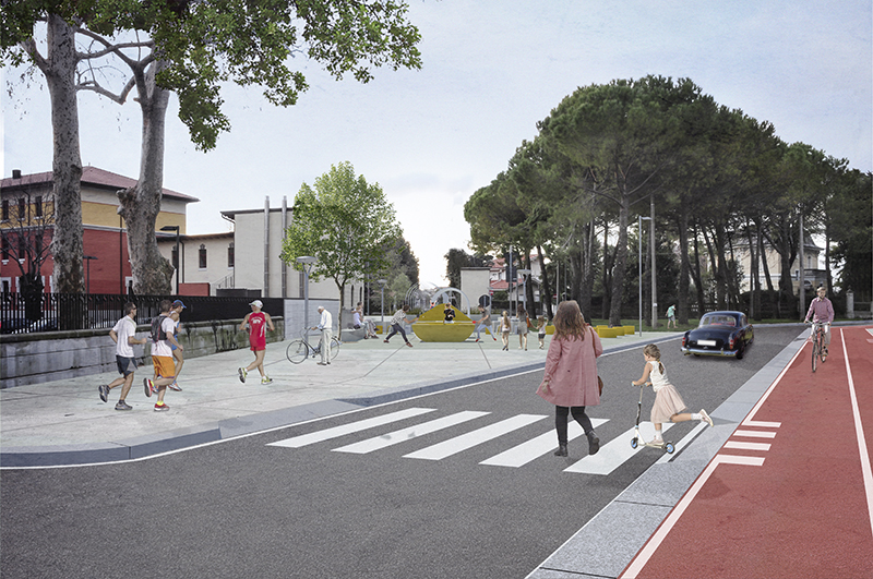
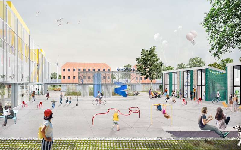
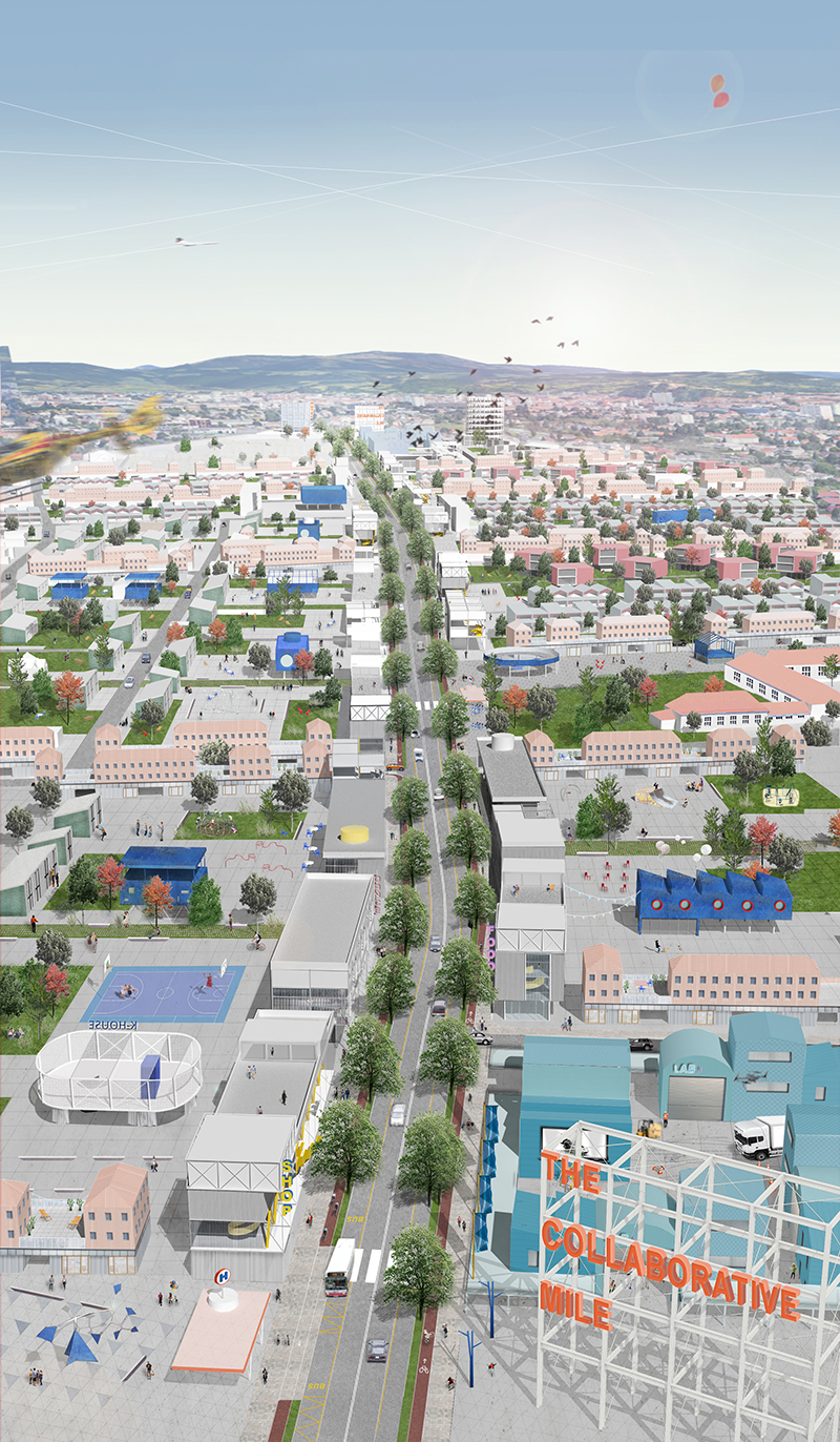
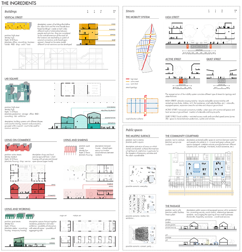
The challenge consists in turning Kärntner Straße, an ordinary access road to the city, into The Collaborative Mile, a well-defined district with specific features (physical, relational and intangible) based on the principles of sharing:

– resource sharing (taking advantage from opportunities and resources of the different actors that operate on the territory);
– knowledge sharing (creating incubators to facilitate short circuiting between ideas and different skills);
– economy sharing (resulting from new productive models -grouping production, services, research and training-, and generated by the new demand posed by new inhabitants);
– transformative capacity sharing (only collaborating and combining resources and goals a transformation that responds to an overall image will be possible).

+

It is necessary to define:

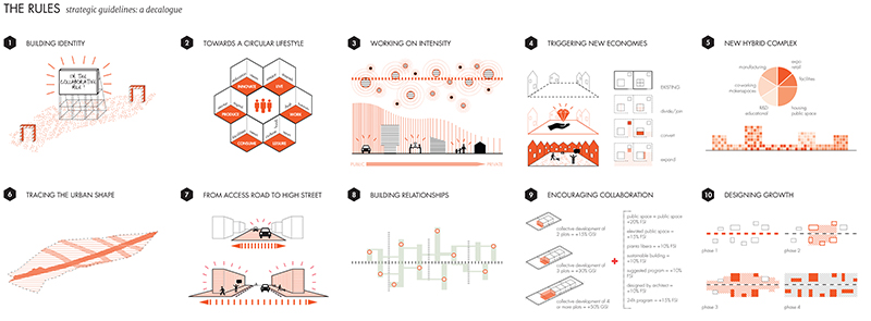
  1. the general rules, a system of strategic guidelines based on a decalogue (>> THE RULES) that define the structure and the development principles.
  2. typologies of intervention (>> THE INGREDIENTS) which, depending on the specified goals and opportunities, can be realized on the territory. They concern: type of buildings, defined in their functional mix, size and formal characteristics; street types (High Street, Active Street, Quiet Street), defined by new road sections and the corresponding buildings density; lastly, the type of public spaces (Multiple surfaces, Community Courtyards, Passages), defined by the public pole to which they are connected (Urban, Starter, Catalyst, Pill), diversified in intensity and attractiveness.
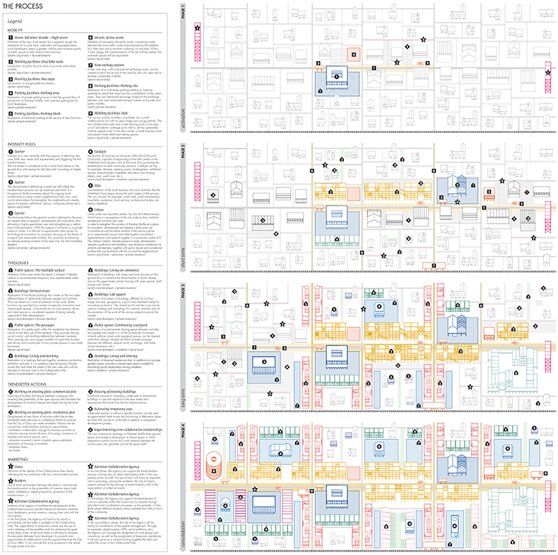
  3. the operating mechanism (>>THE PROCESS), that is, the procedural method that allows to tactically catch the opportunities that unexpectedly come up over time. The Kärntner Collaborative Agency, a municipal council unit in the Collaborative Mile, will play a key role during the process (in promoting the transformative possibilities between residents and local operators, in supporting projects development, in coordination, in organizing events and in space management).

CREDITS

type: ideas competition
result: finalist
cliente: City of Graz

GIARDINI DI FALANTO

enhancement of Mar Piccolo

GIARDINI DI FALANTO

reactivation of Mar Piccolo territory | Taranto | 2016-18


#strategy #landscape #slowmobility #reuse #infrastructure

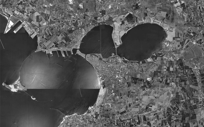
The territorial unit of Mar Piccolo is a naturalistic and archaeological area with a totally unexpressed potential value. This place is unique for its natural conformation (the two seas of Taranto), for the wetland and marine biodiversity that it welcomes despite the state of degradation and pollution, and for the historical and archaeological presence still visible today. The task is to define an innovative and integrated territorial development model that considers the redevelopment of a degraded area as a complex multidisciplinary process, self-sustaining and capable of generating new economies.

Giardini di Falanto is therefore a long-term and broad planning framework, which aims to host different project initiatives, carried out by different subjects, but all directly or indirectly linked to the identity of the areas of Mar Piccolo, to their history and to a few simple guidelines that identify the general rules within the particular processes are included. It is a participatory and shared process to implement sustainable and excellent activities within green and blue economy, social innovation, sustainable mobility, research and technology transfer.

+

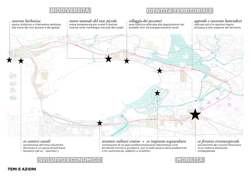
The objective is to build a renewal process starting from the existing, from the available resources of the territory, and working on certain issues (mobility, territorial identity, biodiversity, economic development) that define the guidelines in which the different project actions are then inserted consistently.
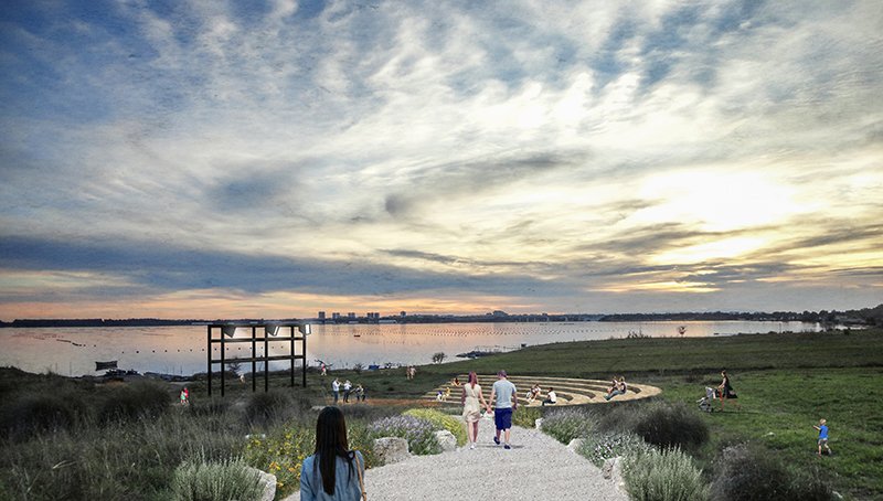
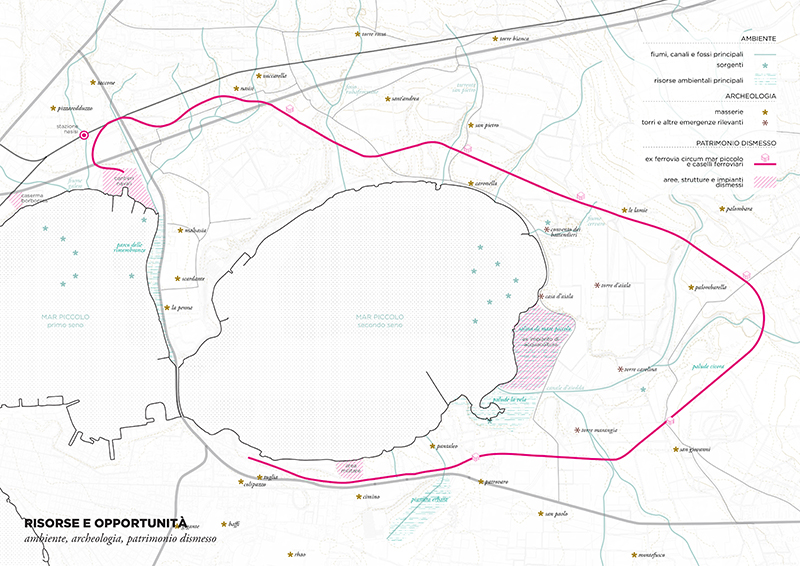
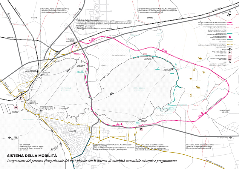
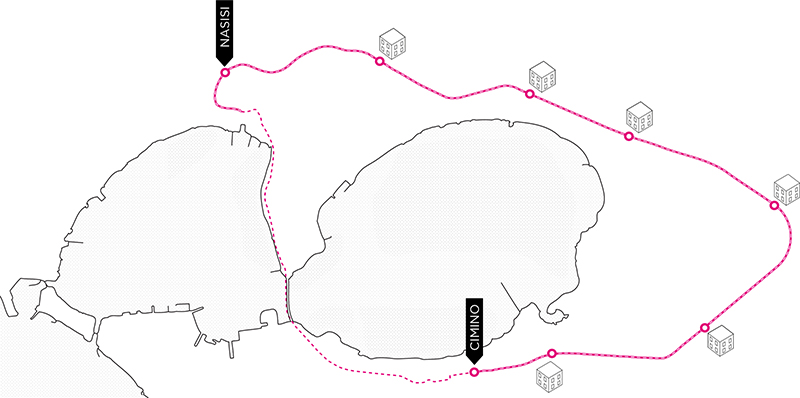
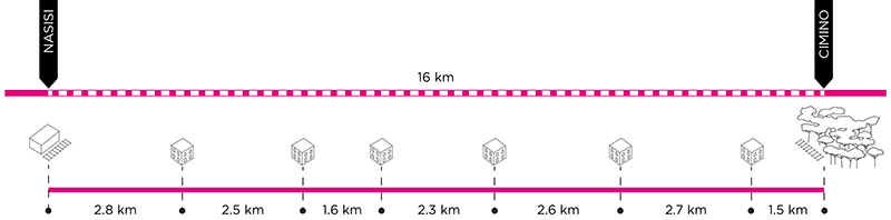
Among these, the starting point for the enhancement of the entire territorial unit is the project to convert the former Circumarpiccolo railway into an equipped cycle and pedestrian path. Once the territory becomes accessible and infrastructured, it can easily return to life, redefining its new role within the city: the infrastructure of the area will be the trigger mechanism capable of stimulating public and private initiatives to start new activities and a network of local economies. The construction of the cycle and pedestrian circuit and the reactivation of the former disused tolls, that can host activities linked to sustainable mobility, tourism and local production, allow the connection of the city and the territory in a continuous, ecological and sustainable way, making it possible to discover and experience the resources and character of the area.

CREDITS

type: research/commission
status: ongoing
client: Ance, Accademia degli Audaci

RIQUALIFICAZIONE DEL CENTRO DI CHAMPOLUC

mobility and new public spaces

RIQUALIFICAZIONE DEL CENTRO DI CHAMPOLUC

mobility and new public spaces | frazione Champoluc, AYAS (AO) | 2016
second phase


#infrastructure #mobility #masterplan #urbandesign

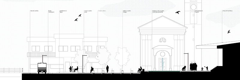
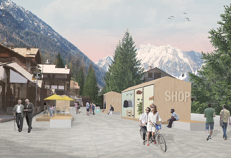
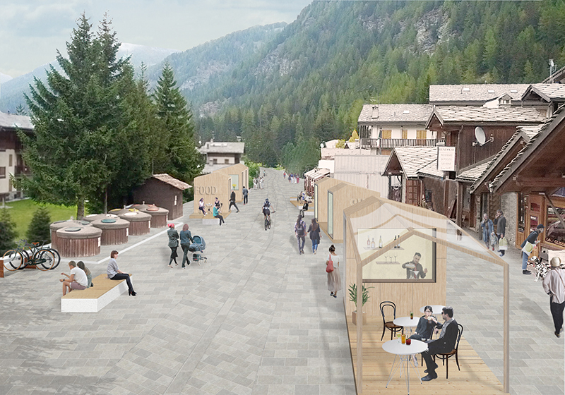
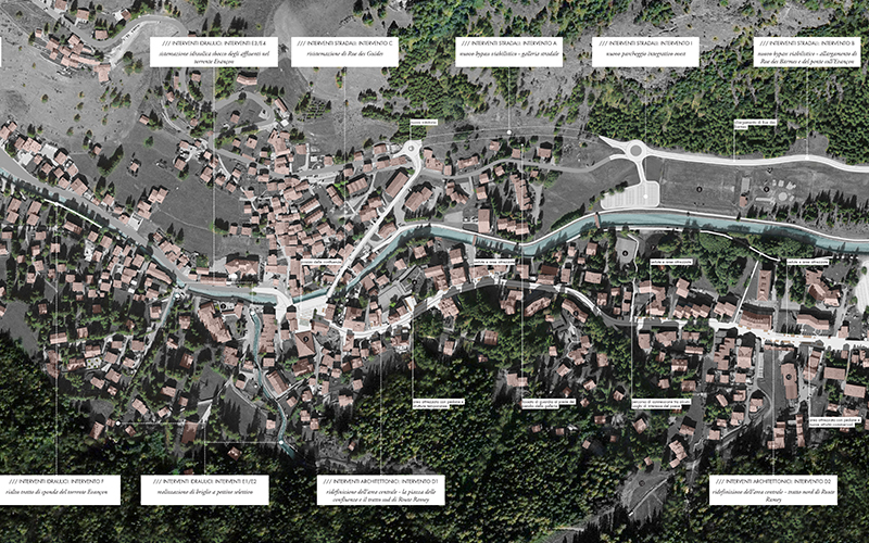
The proposal for Champoluc consists in the definition of an integrated system of vehicular mobility and pedestrian and cycle paths, capable of relating the different functional, morphological and landscape components of the urban system. Through the reorganization of route hierarchies, the networking of attractor nodes in the urban area and the definition of public and aggregation spaces, it will be possible to highlight the qualities of the place and strengthen the touristic, receptive and commercial potential of Champoluc.

+

The interventions are aimed at achieving, in particular, three objectives:

> reducing the crossing mobility from the urban center:the construction of a new by-pass road allows the removal of the crossing traffic from the urban center, which becomes predominantly pedestrian; at the two ends of the town, three exchange parking lots permit to leave private vehicles and proceed towards the center by foot or with sustainable transport systems.

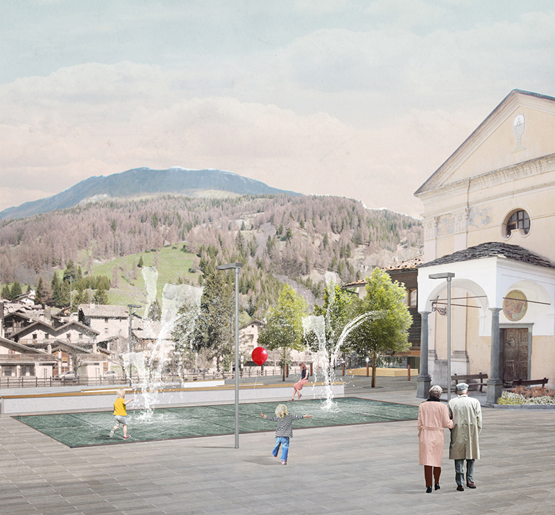
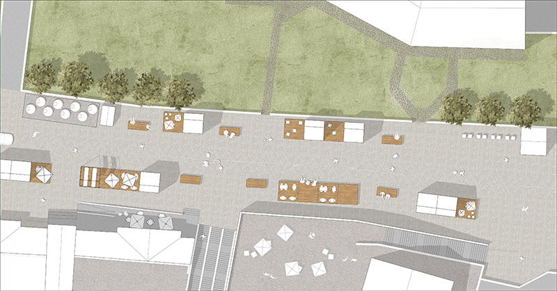
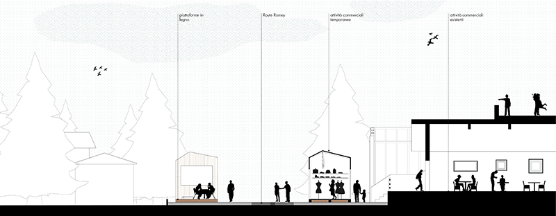
> redefining the system of public spaces and collective areas:the limitation of vehicular entrances in the built-up area allows the configuration of a continuous and protected system of public spaces, with a receptive and commercial vocation; the axis of Route Ramey and the central square become the catalysts for the construction of urban identity.

> make the waterways safe:with targeted operations along the watercourses it is possible to secure the most critical points from flooding, protecting the built-up area and collective spaces.

Through this series of interventions, the identity of Champoluc will be strengthened as a place of excellence in hospitality and in alpine tourism.


CREDITS

type: restricted design competition
result: second phase
client: Municipality of Ayas
with: F&M Ingegneria

RACCONTI DI TERRA E DI MARE

requalification of the waterfront

RACCONTI DI TERRA E DI MARE

masterplan for the waterfront from Porto turistico to Colle Balaguer | Alghero | 2015


#masterplan #waterfront #publicspace

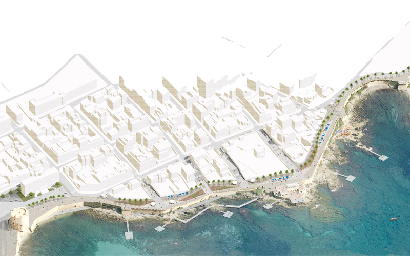
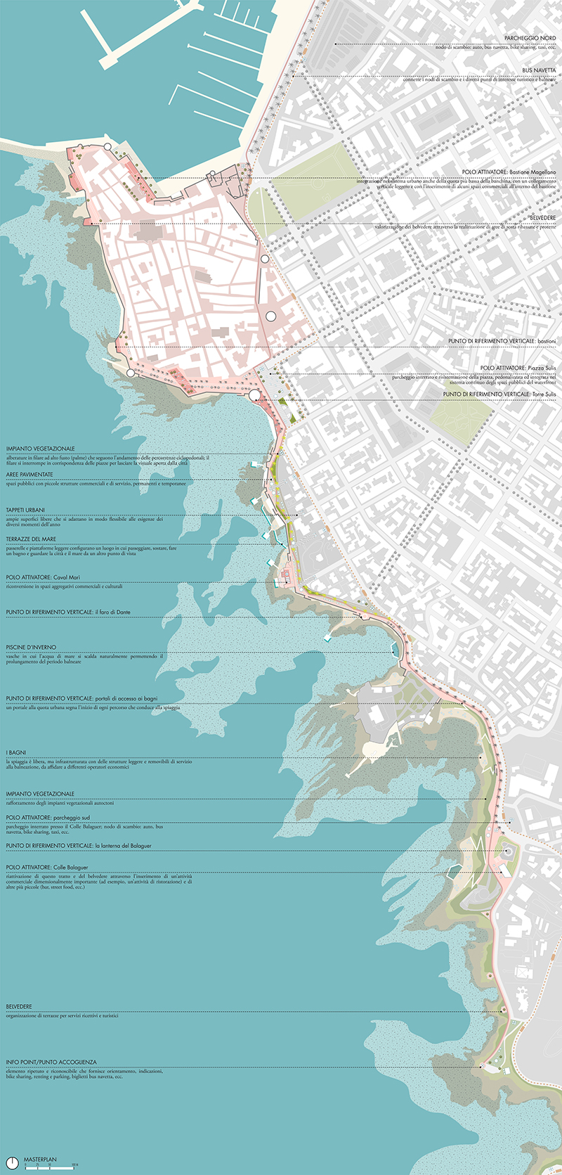
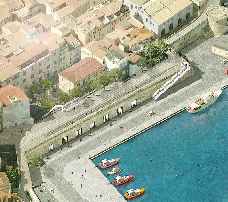
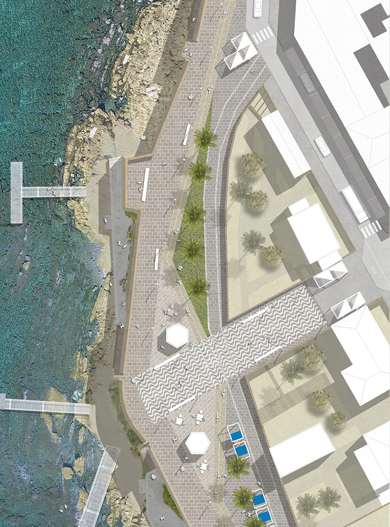
L’idea che si propone per l’area oggetto di intervento è quella di rendere il lungomare un’infrastruttura urbana, un sistema continuo ed integrato fondato su delle forti reti di mobilità pubblica e sostenibile e da sequenze di spazi pubblici e privati ad uso pubblico. Un luogo accentratore per il quale si prevede una densità urbana di funzioni, di attività, di socialità, tale da rafforzare il suo carattere di spina dorsale della città.

+

Il nuovo lungomare di Alghero è un’infrastruttura contemporanea con una sua riconoscibilità e identità complessiva, ma che è capace di interagire ed adattarsi lungo il suo percorso con le realtà che interseca e con cui stabilisce nuove relazioni e interpolazioni. In ogni tratto il lungomare assorbe le caratteristiche e risponde alle vocazioni del tessuto circostante, mettendone in luce le potenzialità ed eccezionalità. Percorrere il nuovo lungomare di Alghero vuol dire percorrere la memoria e le tracce che le diverse epoche hanno depositato nella città.

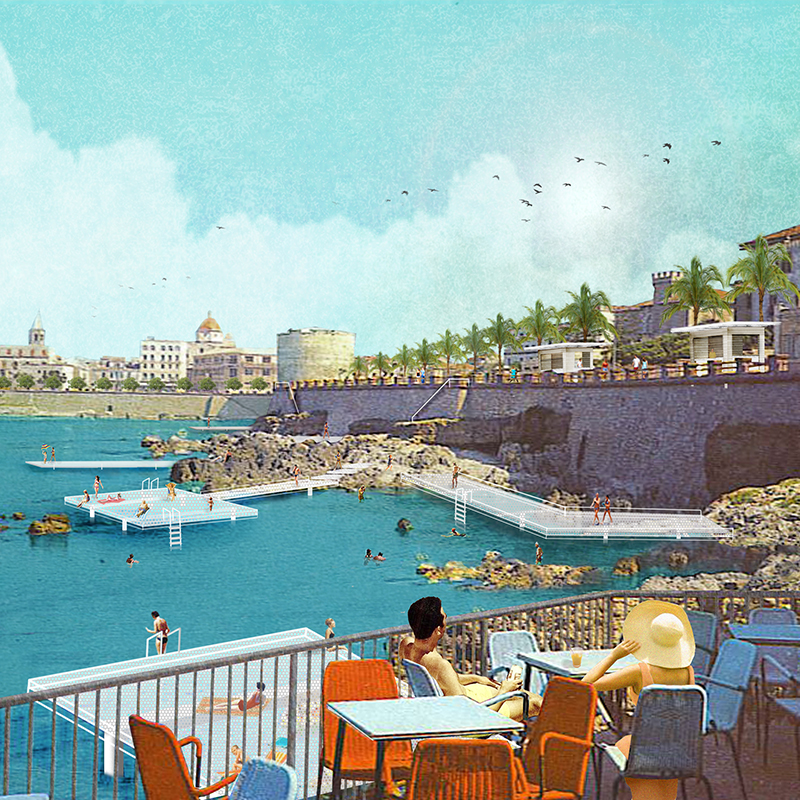
Il nuovo lungomare di Alghero è un luogo attivo, capace di attrarre alla scala urbana prevedendo spazi flessibili, adeguati ad un event oriented development e, allo stesso tempo, di essere funzionale a rispondere ai problemi e alle necessità più quotidiane della scala locale, integrando spazi che rendano possibile lo sviluppo di una microeconomia diffusa che reagisce in modo dinamico ai cambiamenti stagionali.

Il nuovo lungomare di Alghero è per questo un’infrastruttura adattabile e flessibile; un sistema integrato basato su alcune regole strategiche alla scala dell’intero intervento e su alcuni nodi particolari da riattivare capaci di diventare motore economico per la trasformazione.

CREDITS

type: ideas competition
client: Comune di Alghero

GUARDA-MI

redevelopment of the Cavalcavia Bussa

GUARDA-MI

redevelopment of the Cavalcavia Bussa | Milano | 2014

winner – in progress


#publicspace #infrastruttucture #bikemobility #urbanregeneration #urbandesign #multiplieuse #temporary #flexibility #playground #sportfacilities

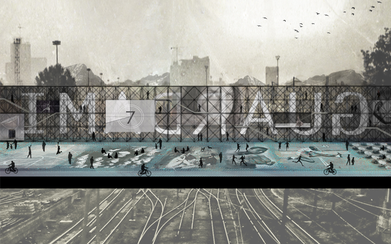
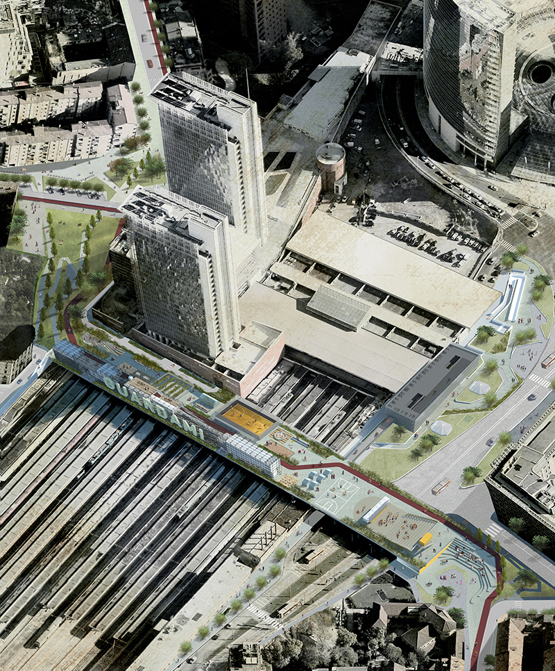
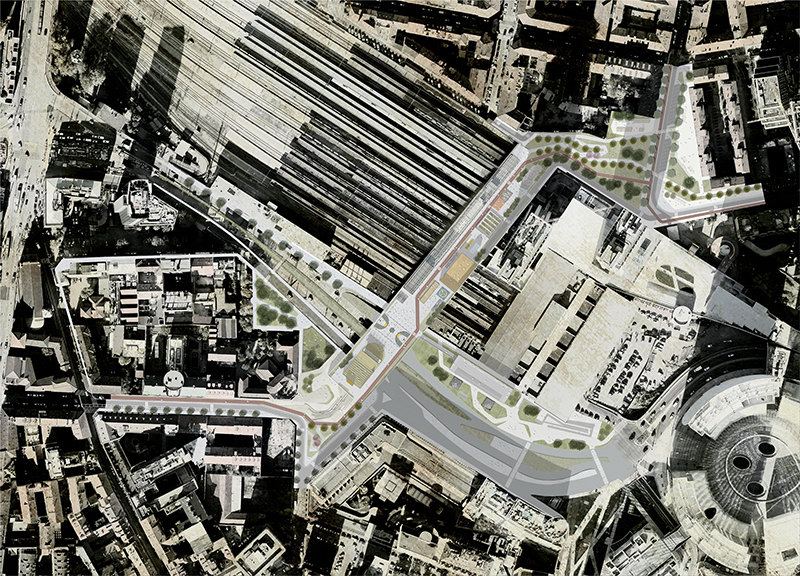
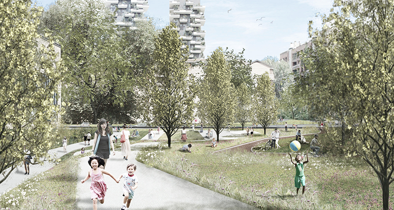
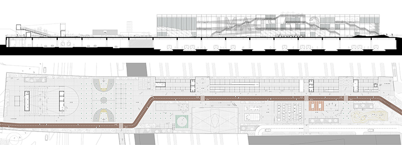
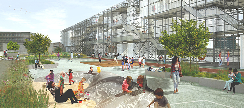
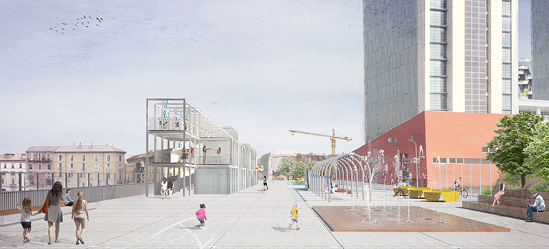
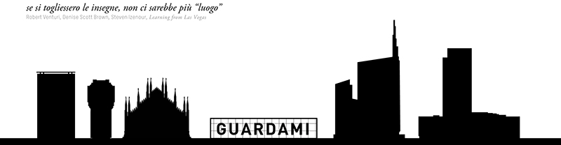
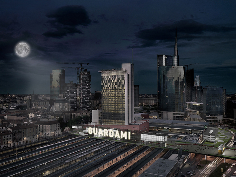
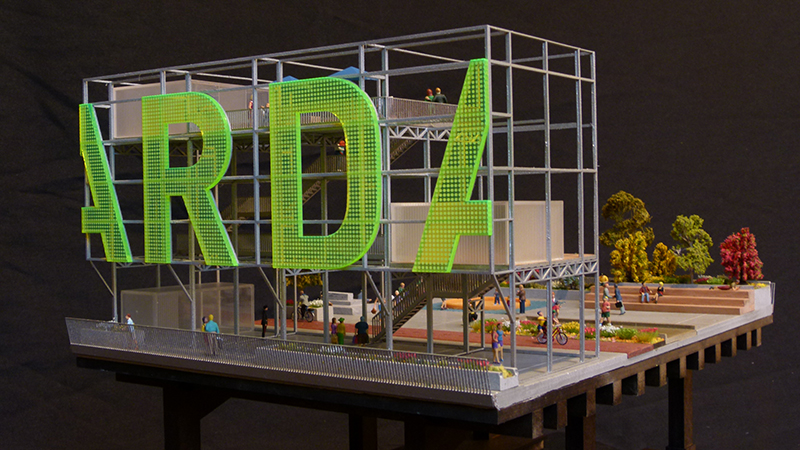
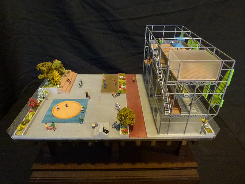
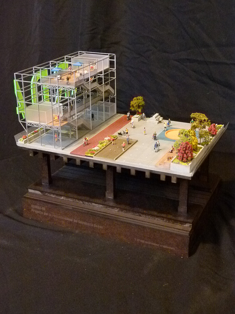
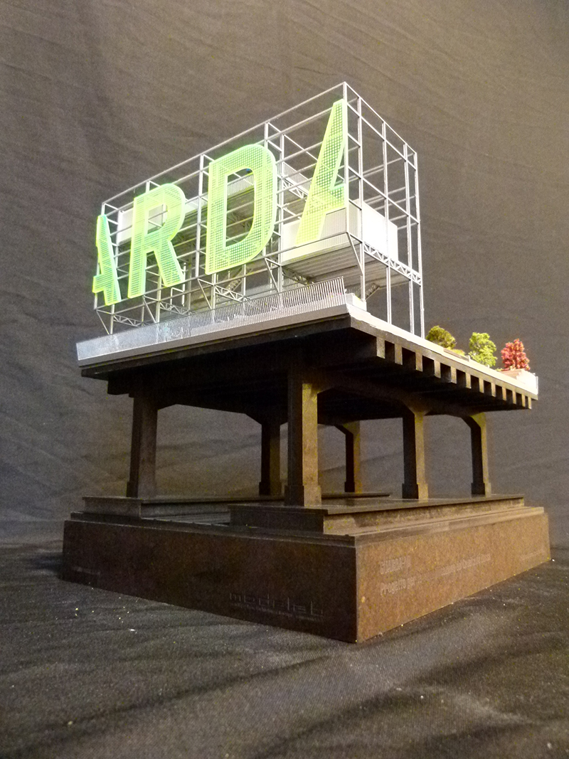
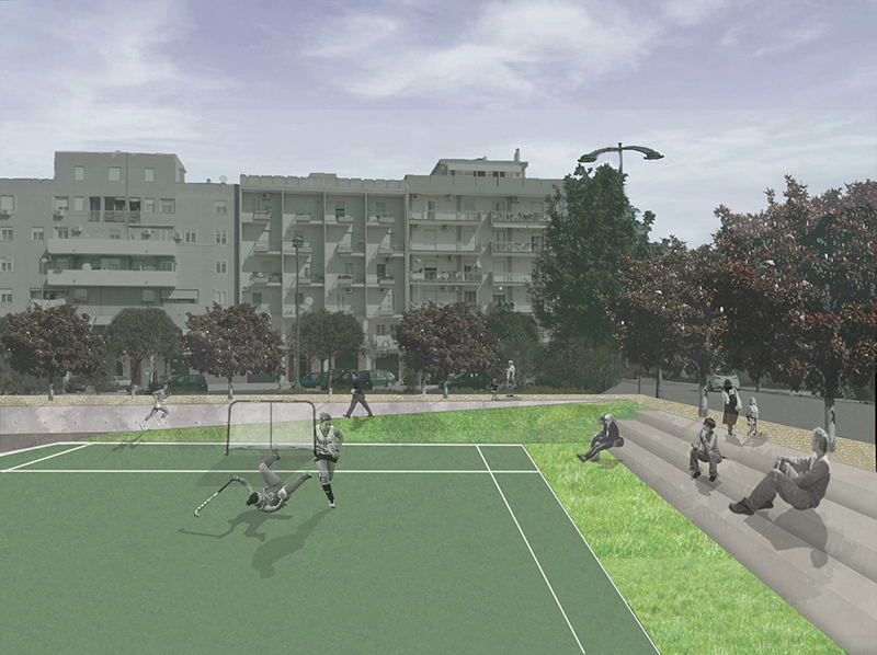
GUARDA-MI is the redevelopment project of the Bussa Overpass and it’s connections to the city in a continuous system of public and green spaces.

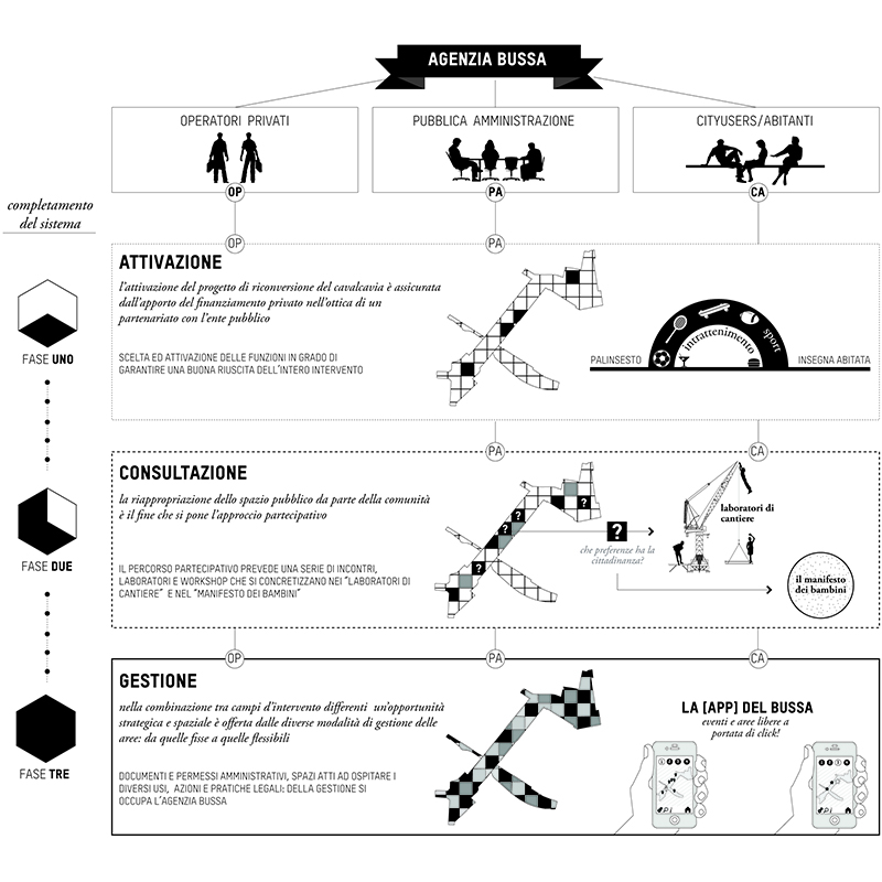
GUARDA-MI consists in an operating strategy that can transform a space that has lost its urban function in an extra-space, a living and lived space, returning it to the city. The transformation project will be progressively included in the collective imagination of the urban landscape as a place where, assuming a certain amount of responsibility, it will be possible to lay the foundations for alternative models of development based on temporary uses and adaptability, on the interaction between the urban actors that are involved at diff erent levels in the processes of transformation and on the direct involvement of users.

+

The redevelopment of the overpass is designed to create a place with its own identity, yet changing and constantly evolving: a clearly defi ned space but where everything is still possible. For this reason the overpass and the two head points have been “infrastructured” according to a few general rules that include an open process with wide margins of adaptability (both regarding the market request and the constant changes of demand) and that ensure, in each moment of the urban life cycle of the intervention, a correspondence to the overall image of the proposed project.
CREDITS

type: restricted design competition
result: winner/ongoing
client: Comune di Milano
with: Guglielmo Bartocci, Elisa Borgognoni, Agnese Monica, Giovanna Perdichizzi
model: Modelab


PREDAZZO: UNA MARCIA IN PIÚ

bike and pedestrian network

PREDAZZO: UNA MARCIA IN PIÚ

bike and pedestrian network | Predazzo (TN) | 2014

second place


#strategy #bikemobility #pedestrianmobility #publicspace #urbandesign #integratedsystem

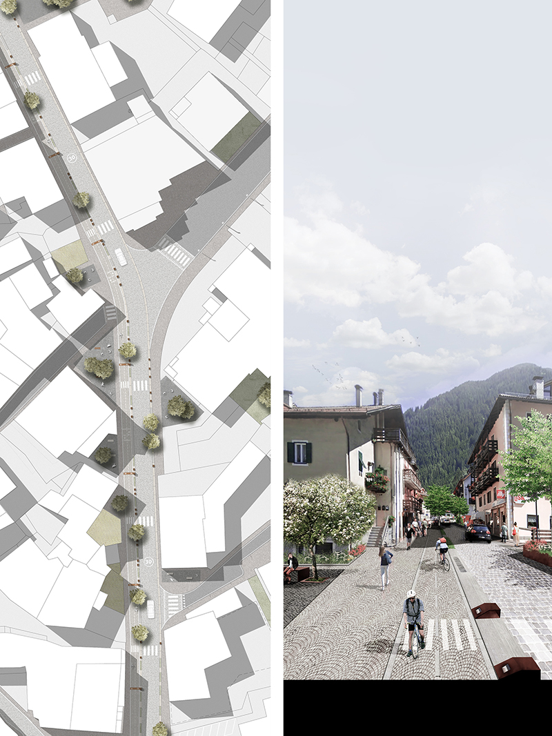
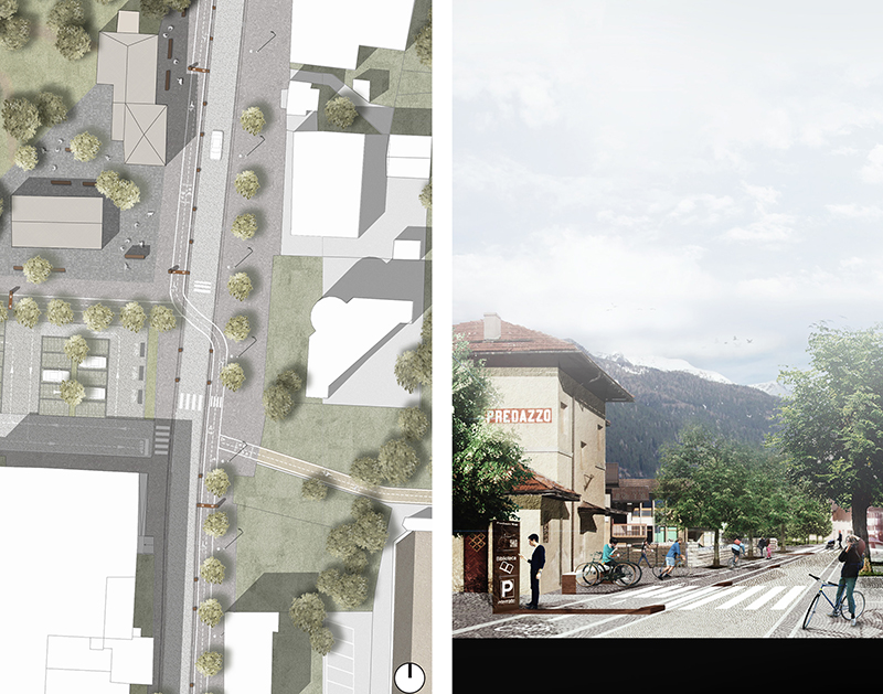
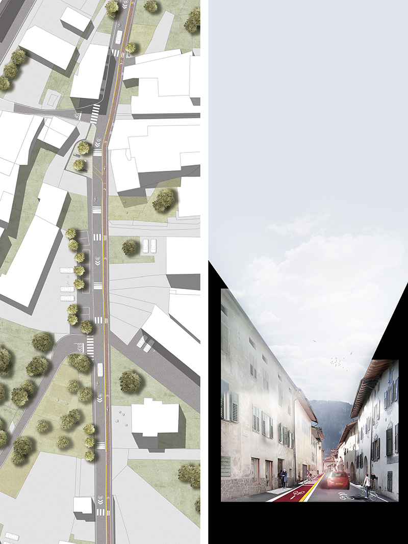
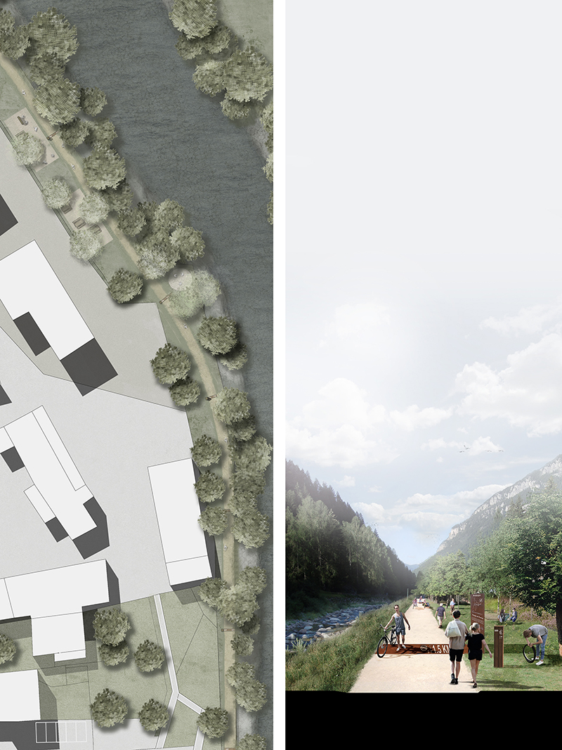
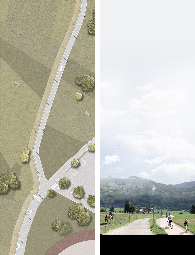
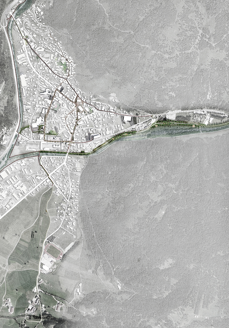
The project proposes to define and communicate a new image for the town: Predazzo as a cyclosystem, a place where pedestrians and cyclists can regain the space that they have lost over time in favor of vehicular traffic, which is instead discouraged and downgraded. A continuous and protected system, which aims to face the new challenges foreseen for the cities of the future: ecology, connectivity, quality of life, sustainability.

+

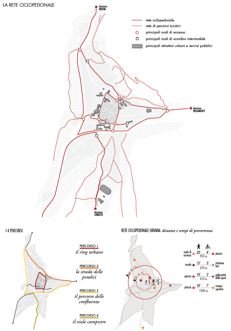
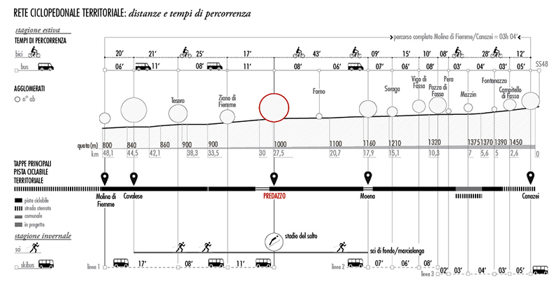
The cyclosystem is a stratified system of cycle and pedestrian mobility, capable of networking, physically and virtually, all the public spaces and attractions of the territory, defining new opportunities and occasions for a sustainable urban development, from a spatial, environmental, economic and social point of view.

The cyclosystem consists of four main routes (il Ring urbano, la Strada delle pendici, il Percoso delle confluenze, il Viale campestre) and their interconnections; each of them has its own specific vocation connected to the context and to the essence of the areas. They are four paths, even though thematic and different for morphology, position, aesthetics and role in the urban economy, that refer to and recall an overall unitary design that allows to rebuild and reinforce the territorial unity.

CREDITS

type: ideas competition
result: second place
client: Comune di Predazzo

TUNE UP, ZUGLÒ!

redevelopment of the areas along the creek

TUNE UP, ZUGLÒ!

redevelopment of the areas along the creek | Europan 12 | Budapest, Hungary | 2013

special mention


#urbanregeneration #strategy #temporary #publicspace #slowmobility

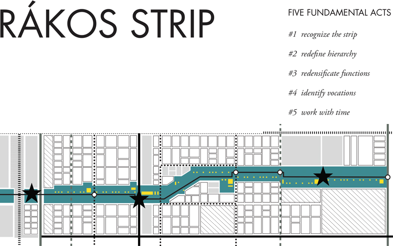
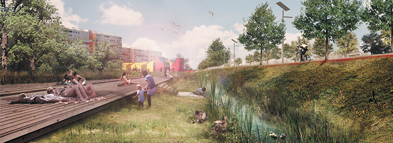
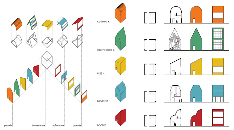
Tune up, Zuglò! is a project for the re-tuning of the district within the urban structure, preparing it for future scenarios now not exactly predictable, redefining its central role as a connector between the parts and making it a fertile territory for urban experimentation.
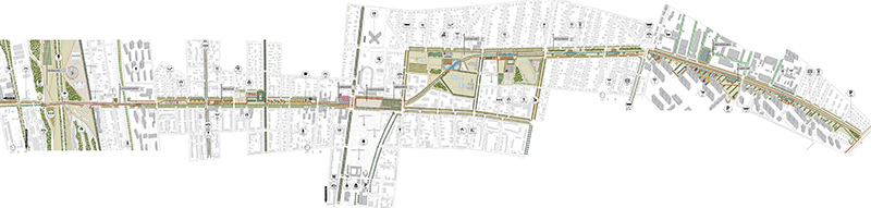
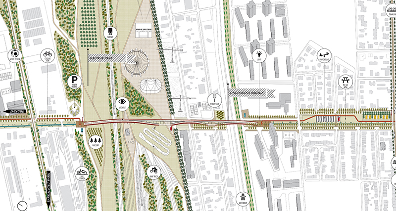
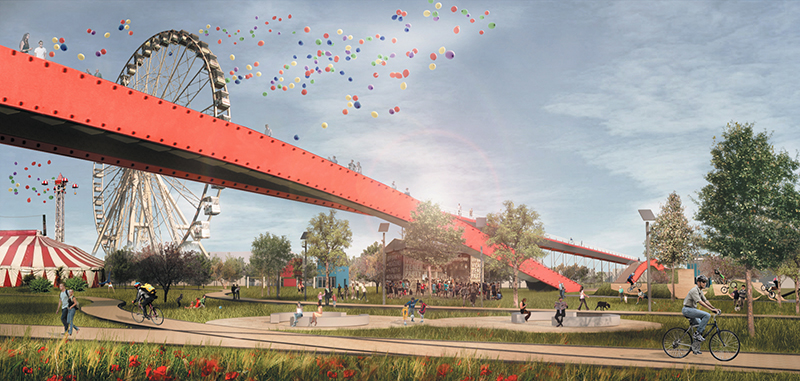
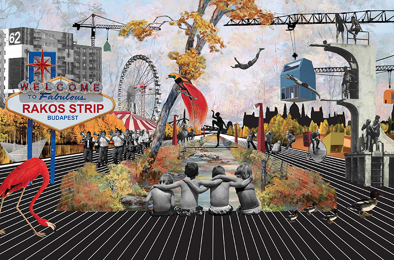
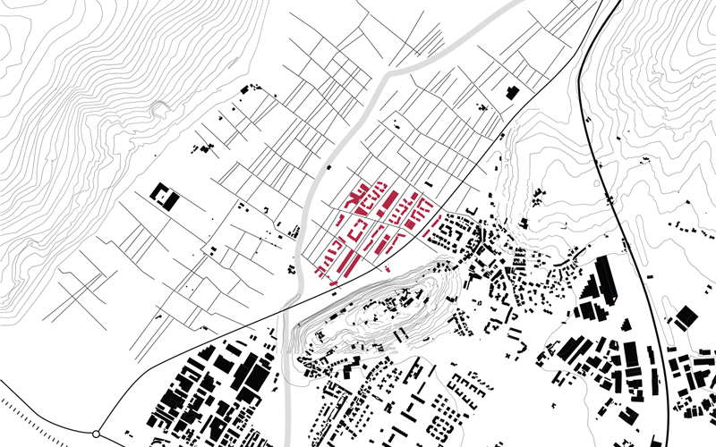
At the local scale the purposed vision is to transform the Rakos Creek and its underused and indefinite adjacent spaces in the Rakos Strip, an active and vital space. The strip is a contemporary infrastructure, with its own overall identity, that interacts and adapts to the reality it intersects and with whom it establishes new relationships, able of regenerating a common identity.
Through a series of interventions, some systemic/strategic, others site-specific, it will be possible to take advantage of the current moment of market’s stasis and of the planning indeterminacy, in order to testing modalities, languages and spatial alternatives, reach an urban development more aware, ecological, economic and sustainable.

CREDITS

type: ideas competition
result: special mention
client: City of Budapest

ECOBORGO

mixed-use development

ECOBORGO

masterplan for a new mixed-use settlement | Calenzano (FI) | 2012

special mention


#masterplan #development #mixeduse #landscape

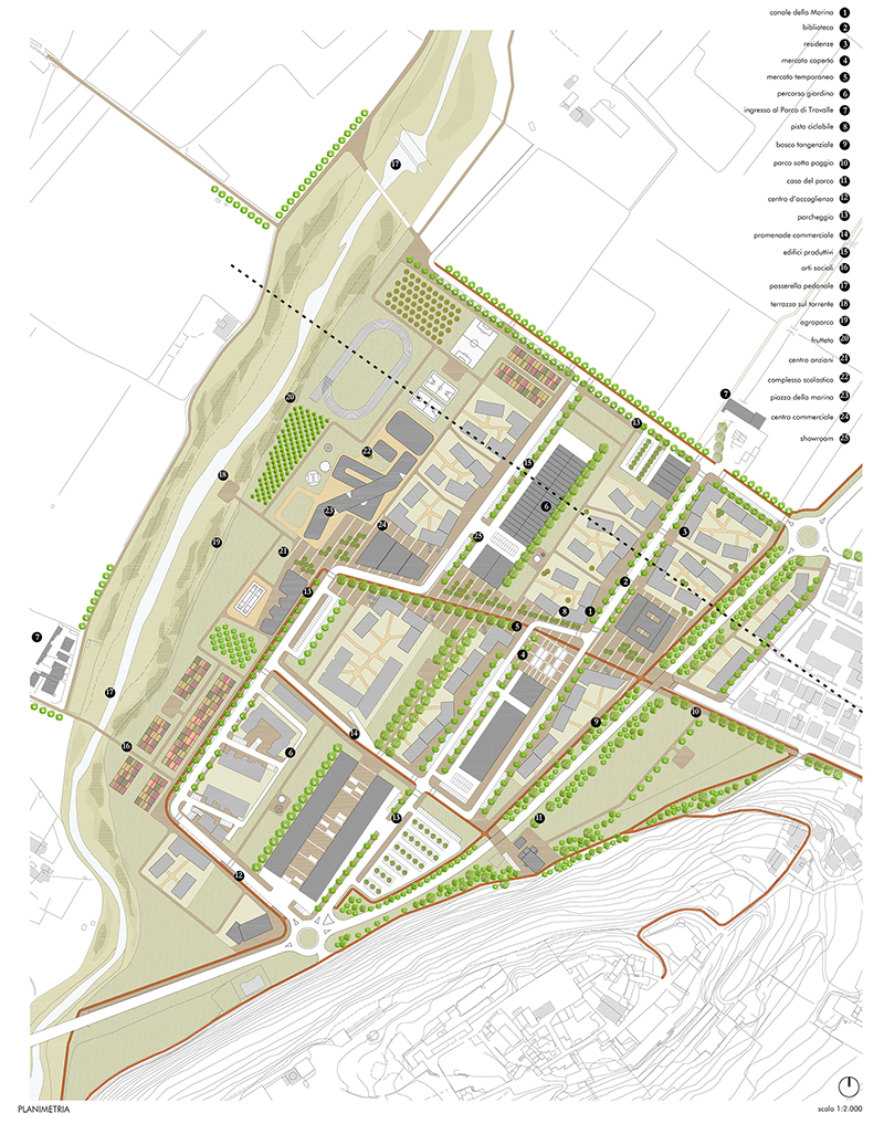
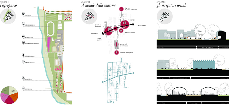
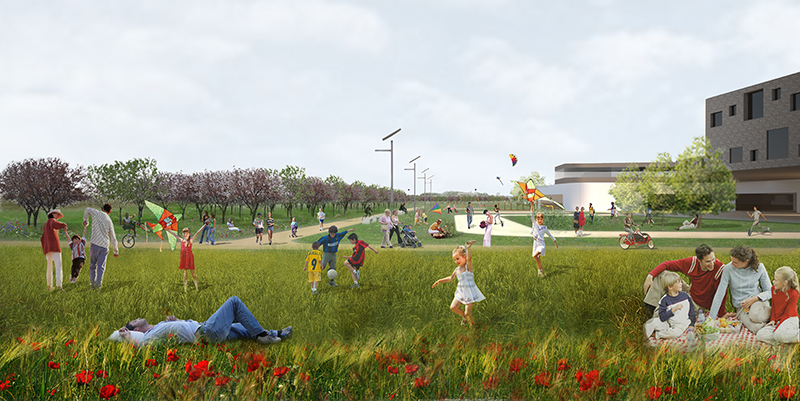
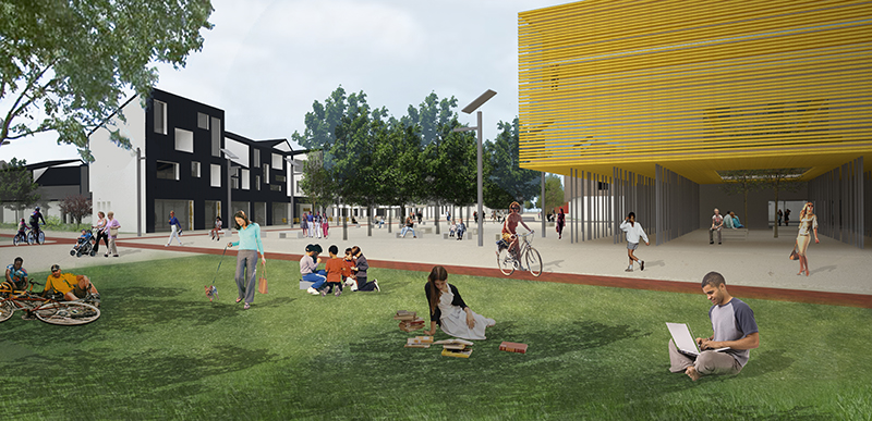
Le scelte progettuali definiscono un sistema generale di parcellizzazione dello spazio impostato sulla trama agricola. In questo impianto, che si costruisce per fasi e secondo ampi margini di flessibilità nel tempo, si persegue un obiettivo di mixitè funzionale che favorisca l’incontro e la costruzione di un solido tessuto sociale, evitando la concentrazione delle diverse destinazioni d’uso da insediare in grandi aree monofunzionali.

+

La strategia che definisce il nuovo insediamento nell’area di Dietro Poggio consiste in:

– Recuperare i tratti del territorio: riconoscere gli elementi che permangono invariati nel corso del tempo e restano costanti tali da costituire il fondamento del riconoscimento dell’identità; – Tendere alla mixitè: recuperare la complessità e la stratificazione di funzioni, di persone e di attività proprie della città storica, che rendono possibile il casuale, l’incontro, lo scambio, ossia tutto ciò che il sistema non può prevedere; – Trama come infrastruttura sociale: la trama agricola (struttura del nuovo insediamento) divide ma allo stesso tempo irriga, caratterizzando il suolo che attraversa, portando ricchezza e vitalità; – Confini come spazi: gli spazi di confine sono il punto di incontro che filtra realtà diverse (parco agricolo e insediamento, insediamento e centro storico); devono essere luoghi ben definiti, dotati di una propria identità, che rendono il nuovo insediamento non una periferia, ma un luogo di qualità; – Pensare eco: lavorare in maniera ecologica, economica e sostenibile introducendo nella progettazione, da un lato l’uso di tecniche costruttive, materiali e essenze locali, dall’altro meccanismi di funzionamento capaci di generare una sostenibilità economica (realizzativa e gestionale).

CREDITS

type: ideas competition
result: special mention
client: Comune di Calenzano

AI CONFINI DELLA REALTÀ

urban revitalization of a residual area

AI CONFINI DELLA REALTÀ

urban revitalization of a residual area | Molfetta (BA) | 2012

winner


#participation #socialinnovation #strategy #community

Ai confini della realtà è una strategia di trasformazione dello spazio che trova il suo motore in ciò che c’è: nelle potenzialità del territorio, negli attori che agiscono o che possono agire sullo spazio, nelle necessità che questi hanno e negli obiettivi che si pongono.
L’area oggetto di intervento è uno spazio di margine, uno spazio vago e sospeso, uno spazio come tanti all’interno dei tessuti urbani, in attesa di esprimere la sua potenzialità. È uno spazio incerto, ma che attraverso opportune azioni di trasformazione può essere reinserito all’interno dell’immaginario collettivo.

+

A questo scopo è stata elaborata una strategia di sviluppo per fasi, aperta e flessibile, semplice ed economica, che include nel suo processo di crescita il coinvolgimento diretto dei diversi attori implicati, a differenti livelli, nei processi di trasformazione spaziale. È una strategia che parte dalla lettura della realtà, sfruttando le disponibilità economiche e sinergiche possibili, e dal tentativo di fornire una risposta a necessità specifiche, corrispondenti ai bisogni della comunità locale.Si propone quindi la realizzazione sequenziale di alcuni episodi spaziali, capaci di caratterizzare il luogo e di contribuire ad una progressiva costruzione dell’identità, prevedendo per ognuno di essi le modalità di finanziamento, di manutenzione e la definizione di tipi di utenze prevalenti. Si è previsto inoltre l’utilizzo di materiali locali o comunque a basso costo, sia per ciò che concerne la realizzazione che la manutenzione. Anche per l’impianto vegetazionale si è seguita la stessa logica, preservando al massimo possibile le alberature esistenti ed inserendo nuove essenze, che rientrano tra le specie autoctone, e nuove aree permeabili, piantate a prato rustico a bassa manutenzione.

CREDITS

type: ideas competition
result: winner
client: Associazione Comunicare il sociale, Comune di Molfetta

LINEAR PARK OF THE ANCIENT VIA COLLATINA

bike and pedestrian route

LINEAR PARK OF THE ANCIENT VIA COLLATINA

archeological bike and pedestrian route from Porta Maggiore to Gabii | Rome | 2012


#infrastructure #bikemobility #pedestrianmobility #intermodality #urbanregeneration #landscape #territory

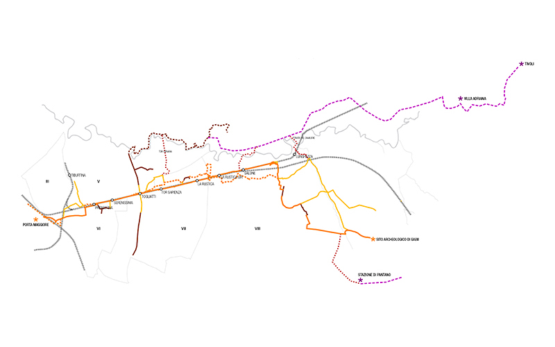
The Porta Maggiore-Gabii equipped cycle and pedestrian path defines an important route towards east in the scenario of the Piano Quadro della Ciclabilità of Rome, along the Rome-Naples TAV track.

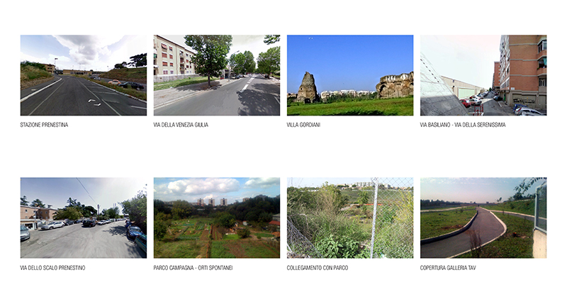
The route crosses four municipalities, for more than twenty kilometres, across urban and extra-urban territories and it configures as an infrastructure with more vocations, from daily use along a section heavily congested by traffic, to occasional for playful, sporting and cycling tourism use. In both cases the interconnection (with other routes, with the neighbourhoods, with the main elements) and intermodality between alternative transport systems are an integral part of the study, such as the research of a deep relationship with the history of the crossed places, both at archaeological and landscape level. In the study area there are traceable, in addition to the remains of the ancient city of Gabii, important historical remains still to be investigated, portions of agro romano and environmental and hydrogeological relevant elements.

+

The project therefore presents itself as a sort of great work of linear, urban and landscape redevelopment, consisting of a fundamental structuring path enriched by built elements, arrangement of open space services, redevelopment of areas trough landscape interventions, possibly with public functions, and connections with the urban and territorial context. It will therefore serve to improve the overall quality of the environment for the inhabitants of the crossed context but also to guarantee for the specific users of the path a greater attractiveness of the landscape crossed and a greater security.

CREDITS

type: commission
status: feasibility study
client: Roma Capitale
with: Elisabetta D’Amato, Michele Testa, Roberto Pallottini, Fabio Martellino

CITY-HOUND

social network of underused urban spaces

CITY-HOUND

social network for the temporary transformation of underused urban spaces

www.city-hound.com


#socialnetwork #temporary #urbanregeneration #socialinnovation

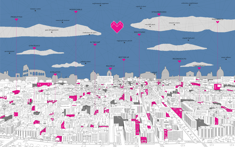
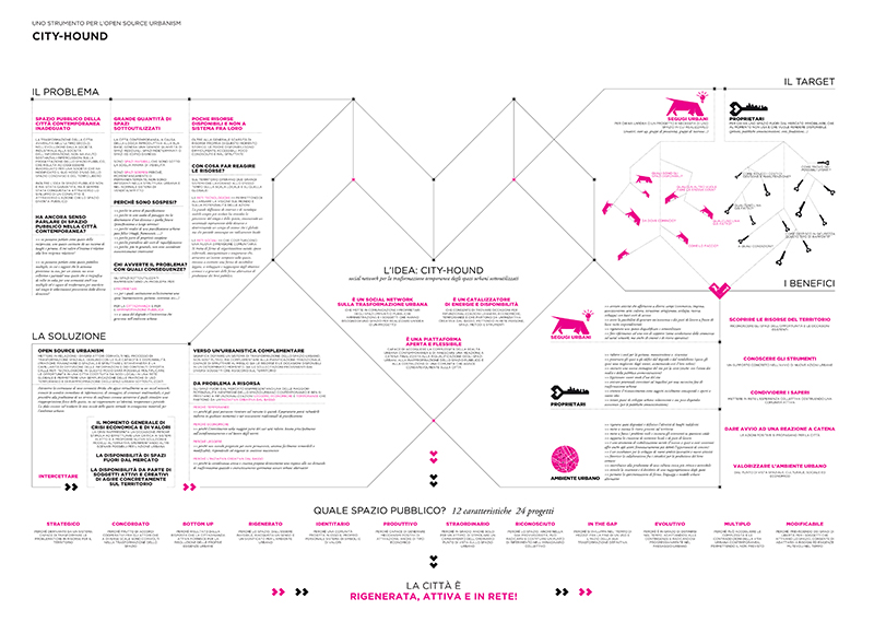
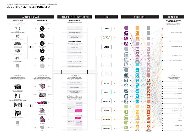
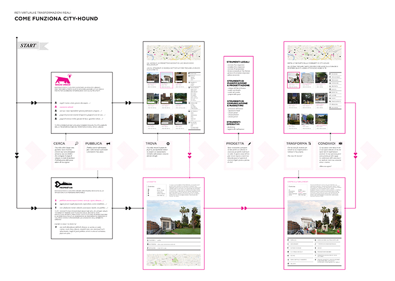
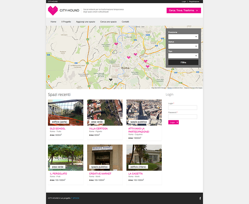
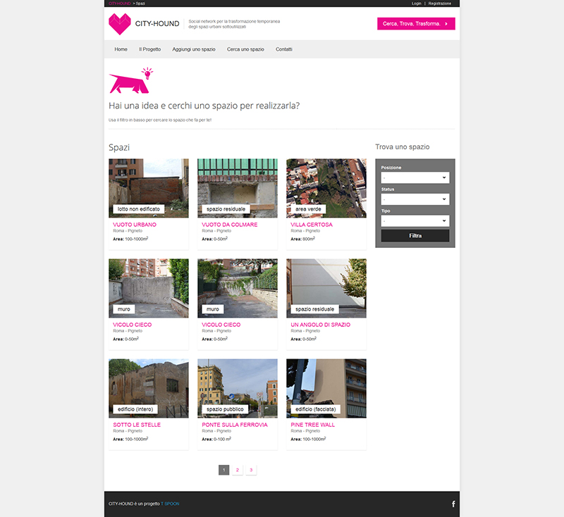
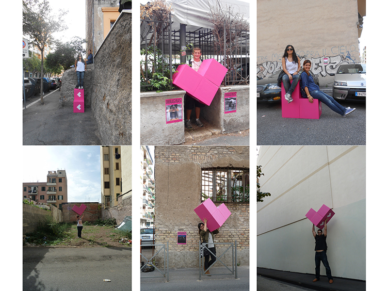
CITY-HOUND connects the owners of spaces (private subjects or public administrations) and people who need spaces (urban hounds) to realize an idea or a project. The goal is to simplify connections and exchanges between owners and active citizens, making it possible to easily realize creative projects with a bottom-up initiative.

 CITYHOUND allows to:
– know the resources of the territory
– discover the spaces of opportunity
– stimulate creativity and the desire for a re-appropriation of spaces
– support the launch of new actions
– reactivate underused spaces
– build an ecological, creative and sustainable community

+

CITY-HOUND is configured as an open and adaptable platform that has two main activation keys. On one hand, there is the motivation of active citizenship and social networks, both of which want to regain possession of a public space that today is no longer able to represent the current society; on the other hand there is the large amount of residual spaces and abandoned buildings, constantly generated by the reproductive logic of the city. Spaces that belong to everyday urban landscape but remain below the threshold of ordinary visibility and that, in a moment of attention to soil consumption like the current one, are well suited for light, economic (in terms of realization, environmental and managerial) and temporary (meaning to respond to a specific moment of the life cycle of the city-organism) re-functionalizations. Active citizenship and underused spaces are the space of possibility in which CITYHOUND operates.

CREDITS

type: research
status: ongoing
web platform developer: WIS web interactive solutions
graphic and video: IKON advertising

ARCIPELAGO VERDE

development strategy

ARCIPELAGO VERDE

development strategy for the capital of biodiversity | Roma | 2012

with Land s.r.l.


#strategy #integratedsystem #urbanregeneration #landscape #territory #masterplan

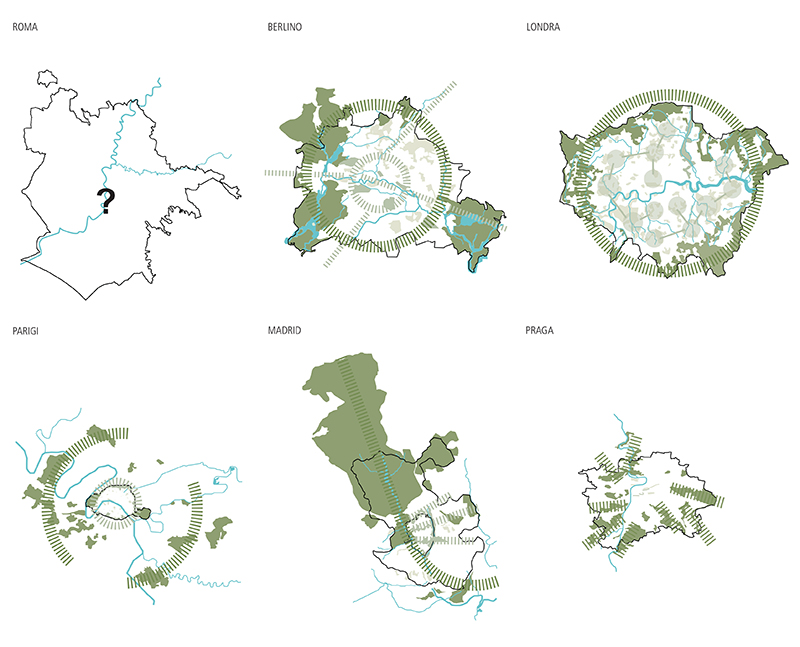
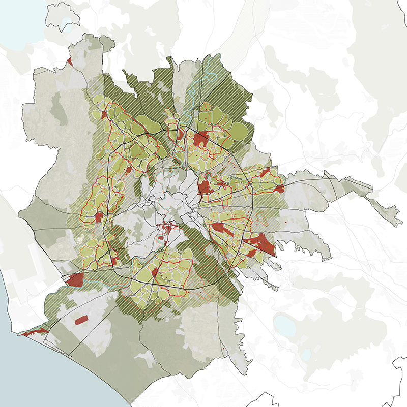
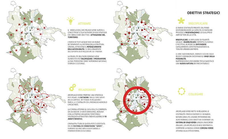
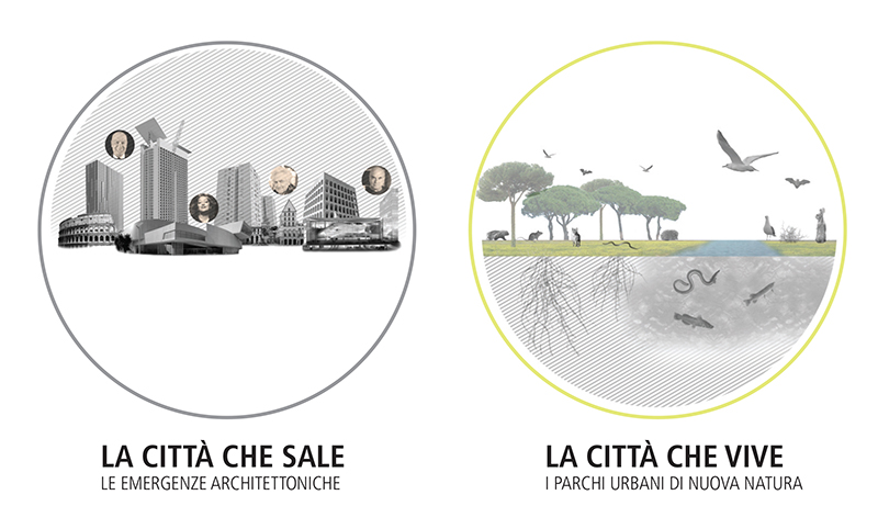
Arcipelago Verde is a strategic project aimed at developing a landscape and environmental vision for a sustainable development of the Municipality of Rome. Starting from the enormous environmental heritage of the municipal territory: the Agro Romano, the historical parks, the natural reserves, the rural areas and the green public spaces, the new vision developed has as principal objective the transition from a protection attitude to the reactivation of the territory.

+

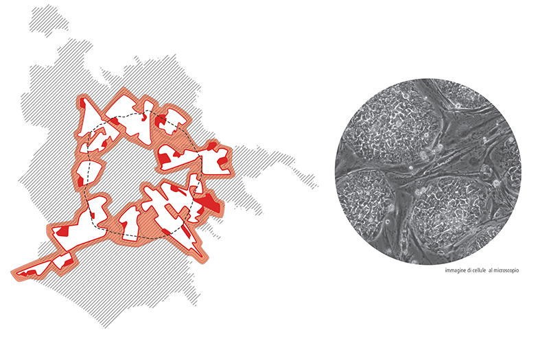
The proposed strategy is based on a contemporary enhancement and promotion of existing parks, on the definition of new large urban parks located on the outskirts of the city as a cure and revival of the centralities and on the redefinition of open spaces, all of which are concentrated along the ring of the Raccordo Annulare.

The Arcipelago Verde theme develops from the vision of the new urban centralities and the established city parks as green atolls, that already exist or are in process of being defined, that need to get back on top in the life of the city and be networked one to each other, aimed to the recomposition of the overall environmental mosaic of 129,000 hectares of green area that belongs to the municipal territory.

CREDITS

type: commission
status: feasibility study
client: Roma Capitale
with: Land s.r.l.

THE BIG HUG

masterplan for the Helsinki metropolitan area

THE BIG HUG

masterplan for the metropolitan area | Greater Helsinki Vision 2050 | Helsinki, Finland

special mention


#masterplan #strategy #urbanregeneration #intermodality

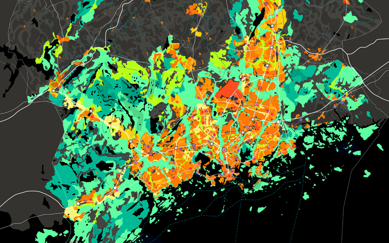
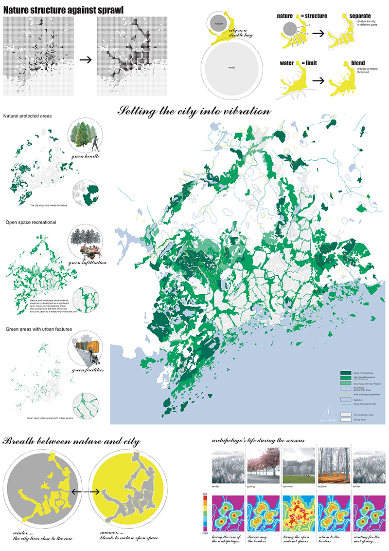
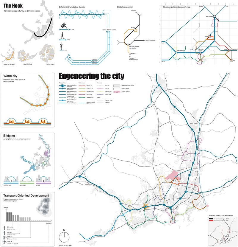
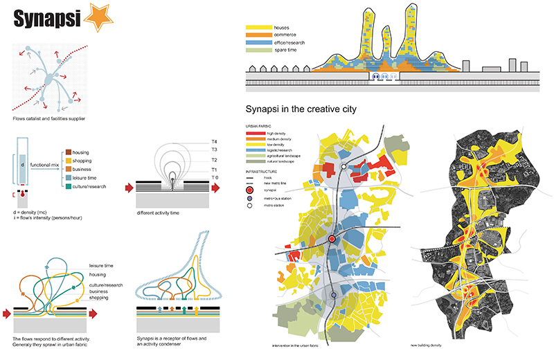
Le 14 municipalità che compongono Greater Helsinki hanno bandito un concorso internazionale di idee con l’obiettivo di raccogliere ed elaborare strategie di sviluppo sostenibile. Il progetto The Big Hug intende costruire una visione unitaria della “Greater Helsinki” che possa strutturare la nuova dimensione territoriale metropolitana della città definendo precise linee guida per lo sviluppo e strumenti gestionali capaci di regolarne la crescita. La struttura del progetto è articolata attorno a tre operazioni fondamentali.

+

Nature structure against sprawl. Ripensare il rapporto tra la struttura del territorio, con la sua natura selvaggia, articolata e diffusa, e la struttura urbana, che segue un modello a bassissima densità che non potrebbe sostenere il consistente sviluppo previsto nei prossimi cinquanta anni.

One city diffrent lifestyles. Il sistema delle infiltrazioni verdi rafforza e definisce la struttura ad arcipelago dell’area metropolitana, un territorio fatto di parti che, pur nell’ottica di una visione unitaria, devono preservare e rafforzare i loro caratteri peculiari.

Engeneiring the city. Il notevole sviluppo urbano deve essere strutturato attraverso lo sviluppo della rete di trasporto pubblico. La spina dorsale di questo sistema, che collega e unifica i diversi arcipelaghi metropolitani, è l’Hook: un fascio infrastrutturale che contiene le principali linee di trasporto pubblico alla scala nazionale, regionale e metropolitana.

CREDITS

type: ideas competition
result: special mention
client: Greater Helsinki municipalities
with: Gualtiero Bonvino, Paola Fusco, Daniela Pastore, Raffaele Patitucci, Davide Sacconi