NEW CELANO CENTER

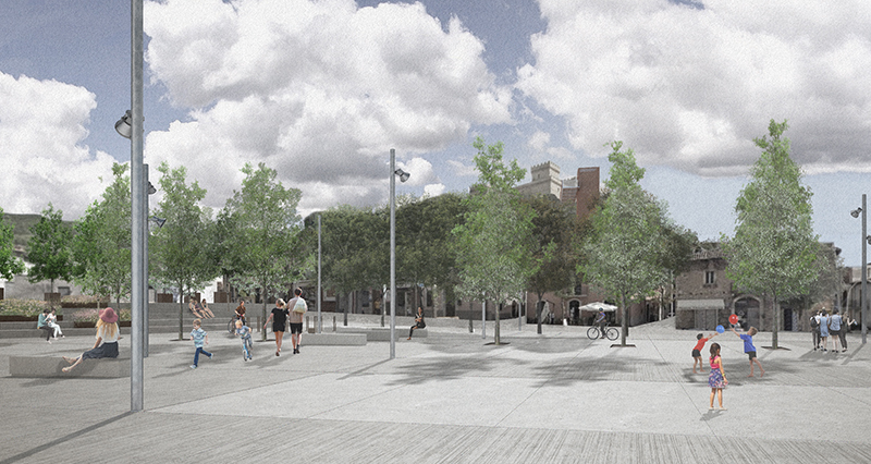
renewal of the old city center public spaces
Sorry, this entry is only available in Italian. For the sake of viewer convenience, the content is shown below in the alternative language. You may click the link to switch the active language.

NEW CELANO CENTER

rigenerazione urbana del centro storico | Celano (AQ) | 2023

progetto vincitore


#spaziopubblico #urbandesign #arredourbano #infrastruttura #mobilità #sistemaintegrato #accessibilità #masterplan #piazza #strada #paesaggio #usimultipli

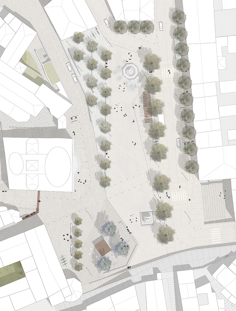
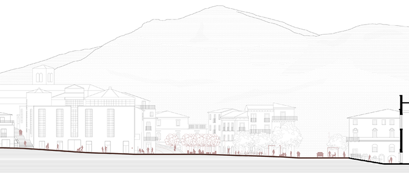
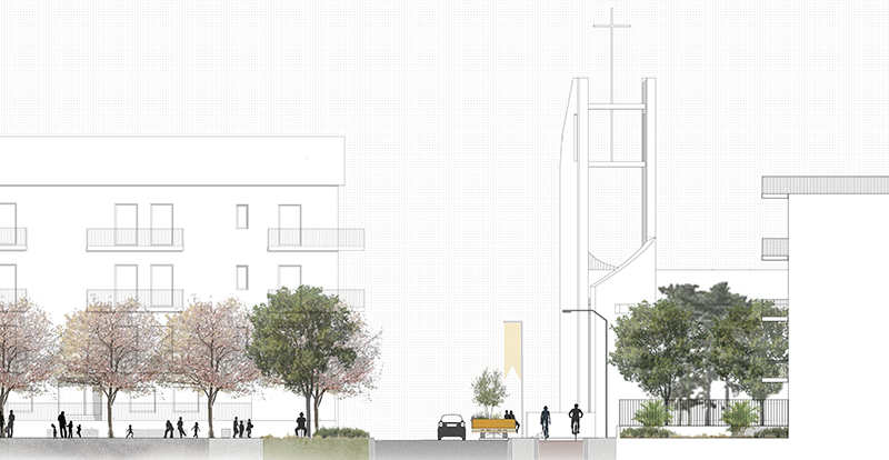
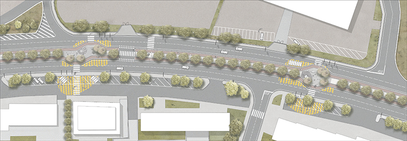
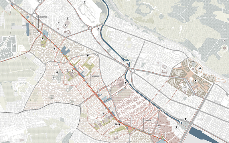
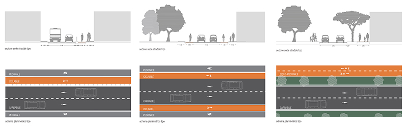
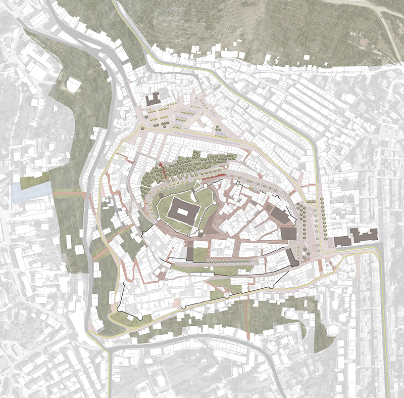
La proposta per Celano consiste nella definizione di un sistema integrato di mobilità carrabile, di percorsi ciclopedonali e spazi pubblici, capaci di mettere in relazione le diverse componenti funzionali, morfologiche e paesaggistiche del sistema urbano. Attraverso la riorganizzazione delle gerarchie dei percorsi, la messa in rete dei nodi attrattori e delle tracce visibili e invisibili che segnano i tessuti, antropizzati e naturali, sarà possibile evidenziare le eccezionalità del luogo e rafforzare la potenzialità turistica, ricettiva e commerciale del paese nell’ottica di uno sviluppo sostenibile, compatibile con le vocazioni e con le risorse del territorio. 

+

Gli interventi proposti sono volti al raggiungimento, in particolare, di tre obiettivi:

>> scaricare il centro urbano dal traffico veicolare:

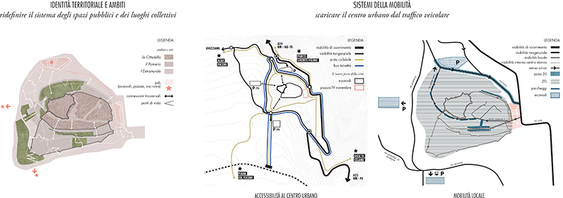
L’organizzazione di un anello di mobilità tangenziale permette di eliminare la carrabilità di attraversamento dei non residenti dal centro urbano, che diventa a prevalenza pedonale; alle estremità dell’abitato, tre parcheggi di scambio permettono di lasciare il mezzo privato e procedere verso il centro a piedi o con sistemi di trasporto sostenibile.

>> ridefinire il sistema degli spazi pubblici e dei luoghi collettivi, visibili e invisibili:

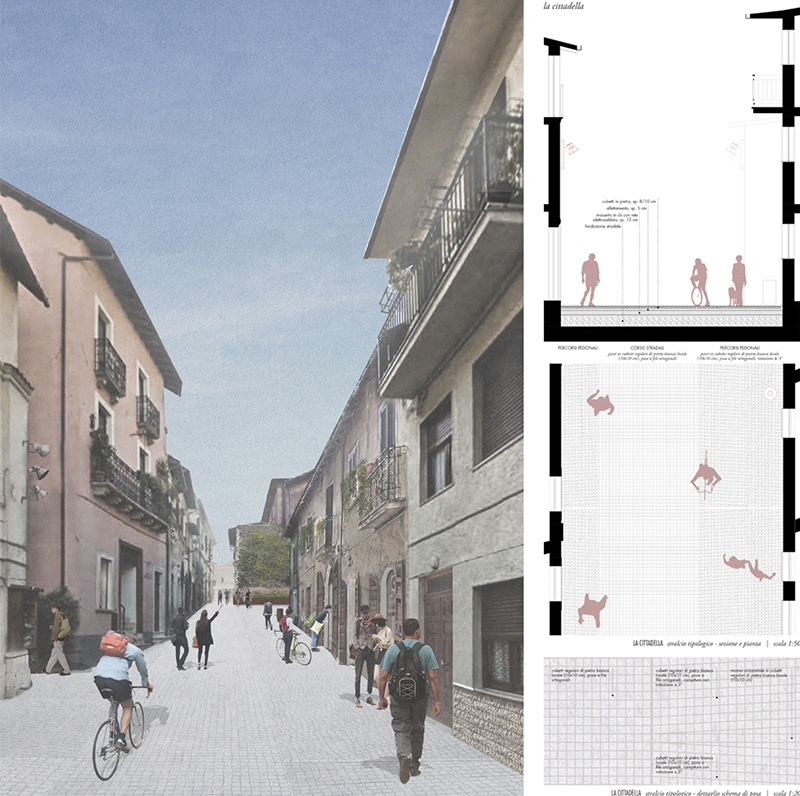
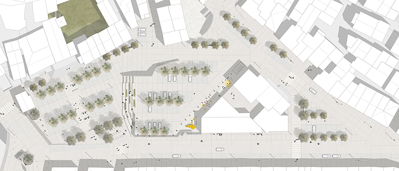
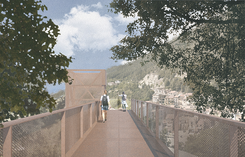
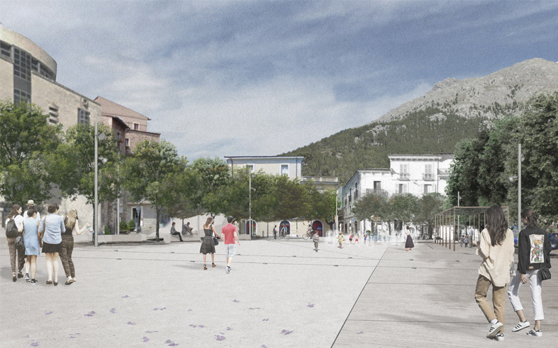
La limitazione della mobilità di attraversamento permette di configurare un sistema continuo e protetto di spazi pubblici, a vocazione turistica, ricettiva e commerciale. Si riconoscono tre ambiti urbani (la Cittadella, il Pomerio, l’Extramurale) con caratteristiche omogenee, in cui si ridefiniscono le reti dei percorsi tematici che ricostruiscono la storia nascosta, delle terrazze verso paesaggi lontani e degli spazi pubblici, che insieme alle due piazze IV Novembre e Aia, diventano i luoghi catalizzatori per la costruzione dell’identità urbana.

>> organizzare una visione coerente da sviluppare nel tempo:

La definizione di linee guida d’azione per i tre ambiti urbani riconosciuti come omogenei, permette di creare un sistema con delle regole generali che rispondono ad una visione a lungo termine, in cui i diversi interventi particolari possono essere realizzati nel corso del tempo, in momenti differenti, e adeguati secondo le necessità.

Perseguendo questi obiettivi si andrà così a rafforzare l’identità di Celano come luogo di eccellenza nell’accoglienza e nel turismo, predisponendola per accogliere le sfide che presenta la città di domani.
CREDITI

tipo: concorso di progettazione a procedura ristretta
risultato: progetto vincitore
cliente: Comune di Celano (AQ)
strutture e impianti: ing. Antonino Papasergio
MERAVIGLIOSO URBANO

bike and pedestrian network

MERAVIGLIOSO URBANO

bike and pedestrian network | Putignano (BA) | 2022

second phase


#strategy #bikemobility #pedestrianmobility #publicspace #urbandesign #integratedsystem #urbanregeneration #masterplan #streetfurniture #urbansquare #playground

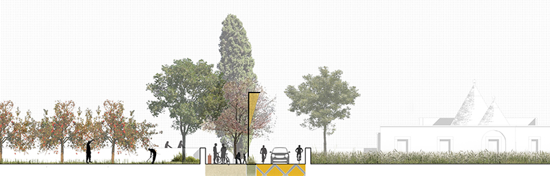
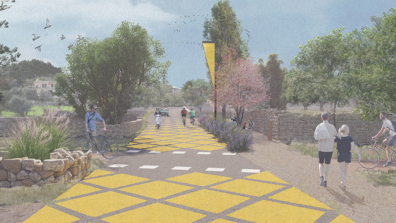
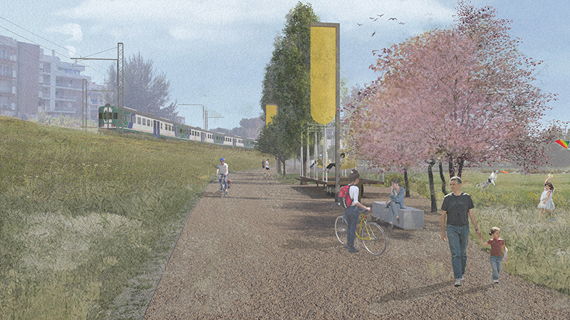
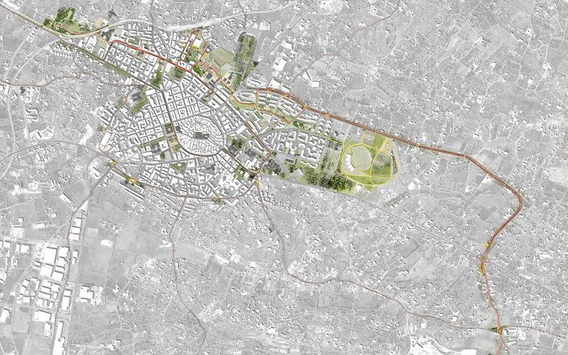
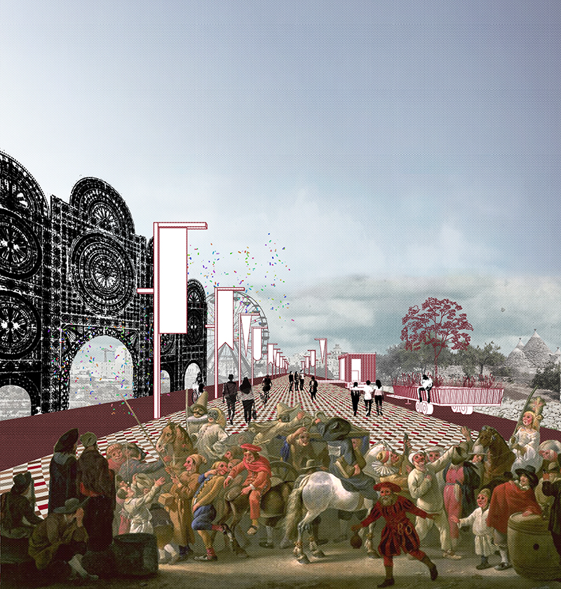
La visione che si propone per l’area di intervento, nel quadro di una struttura generale a livello urbano, è quella di attivare un sistema continuo di spazi aperti, pubblici e condivisi incardinato sulla mobilità lenta e sui sistemi naturali. Dunque, non una linea, ma uno spazio: un luogo accentratore, dotato di sue proprie caratteristiche, per il quale si prevede una densità urbana di funzioni, di attività, di socialità, di scambio, capace di ristabilire e rigenerare un’identità comunitaria e condivisa.

+

La strategia progettuale persegue alcuni specifici obiettivi:

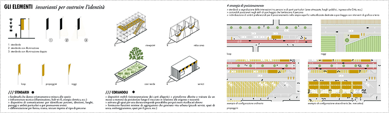
– definire lo spazio e la sua identità, chiara e riconoscibile, qualificata da specifici caratteri fisici e percettivi e dalla ripetizione di alcuni elementi iconici (stendardi e coriandoli);
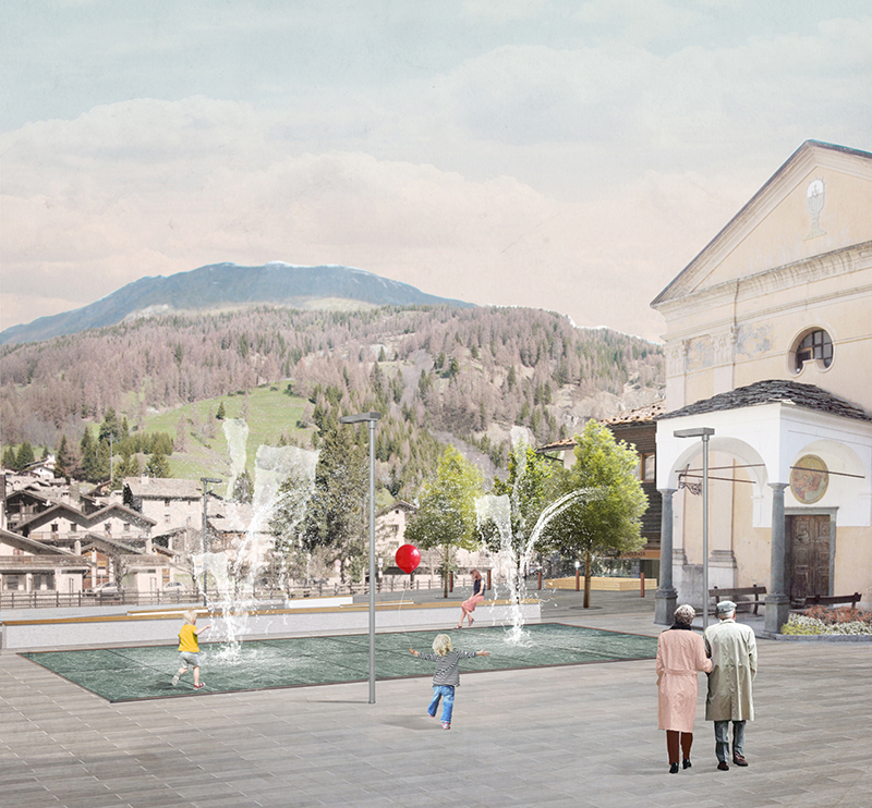
– connettere i punti nevralgici (rete di mobilità territoriale e locale) in un sistema continuo capace di soddisfare l’uso quotidiano e quello saltuario;
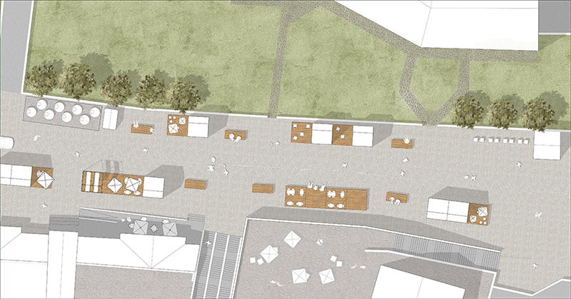
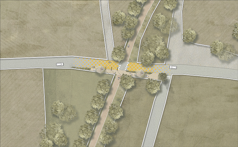
– rispondere alle necessità del contesto attraverso tre tipi di percorsi diversi (il loop, le propaggini, i raggi) che si declinano rispetto all’essenza dei luoghi;

– lavorare con l’effimero (usi temporanei e urbanismo tattico) per sperimentare le trasformazioni urbane nelle aree incerte e indeterminate (le Città e il Parco) e per arrivare progressivamente alle soluzioni definitive, attraverso un processo evolutivo nel tempo;

– integrare l’esistente, muovendosi in modo strategico, stabilendo delle priorità e gettando le basi che predispongano il completamento del sistema in fasi successive.


Con ben saldi questi obiettivi, è stata sviluppata la strategia proposta, che si struttura come un intervento metodologico verificato operativamente nelle aree oggetto di concorso. Il progetto prefigura infatti una visione più ampia, ma più incisiva e performativa sul territorio. Pertanto si è scelto di operare in maniera strategica, organizzando la trasformazione in fasi e strutturando una strategia di sviluppo che sia, da un lato, capace di assorbire modalità alternative per la realizzazione, gestione e manutenzione dei beni collettivi, includendo i diversi soggetti, pubblici e privati, che si occupano di trasformazioni spaziali e, dall’altro, sia sufficientemente flessibile per rispondere ad esigenze, occasioni e necessità, per loro natura mutevoli nel tempo.

CREDITS

type: restricted design competition
result: second phase
client: City of Putignano
consultant: Valerio Tufoni (geology), Kristian Sesto (safety management)

FRONTE/RETRO

linear park on the ex-railway of Fincantieri

FRONTE/RETRO

linear park on the ex-railway of Fincantieri | Monfalcone (GO) | 2018


#infrastructure #park #bikemobility #pedestrianmobility #strategy #masterplan

Lorem ipsum dolor sit amet, consectetur adipiscing elit. Praesent nisi tellus, posuere quis auctor tincidunt, laoreet ut orci. Pellentesque interdum scelerisque venenatis. Fusce id dui at metus vestibulum convallis id id dui. Curabitur nisi nisl, porta eu elementum nec, vehicula eu tellus. Pellentesque in blandit mi. Nullam non justo orci. Sed bibendum ornare scelerisque. Duis blandit a felis ut molestie. Morbi facilisis nisi eros, consequat suscipit ante vestibulum nec. Aenean vestibulum enim ac nulla maximus, ac blandit turpis fringilla. Suspendisse eu nulla lorem. Sed egestas laoreet laoreet.

+

Etiam ante ante, dapibus lobortis eros mollis, dictum aliquam lacus. Ut in neque vitae tellus pulvinar mattis. Aliquam feugiat arcu ac sapien venenatis, facilisis ultrices ipsum tristique. Mauris rutrum mi venenatis ultrices facilisis. Donec a tortor semper, fringilla augue sit amet, dictum turpis. Suspendisse semper orci quis porta mollis. Fusce imperdiet mi sed nisl pulvinar bibendum. Nam non rhoncus enim, quis blandit turpis. Quisque vel turpis ut lacus imperdiet euismod. Cras iaculis ante dolor, vitae porttitor felis maximus at. Ut varius enim vitae nisi pulvinar placerat. Nullam cursus ultrices pellentesque.

CREDITS

type: ideas competition
cliente: local municipality

GIARDINI DI FALANTO

enhancement of Mar Piccolo

GIARDINI DI FALANTO

reactivation of Mar Piccolo territory | Taranto | 2016-18


#strategy #landscape #slowmobility #reuse #infrastructure

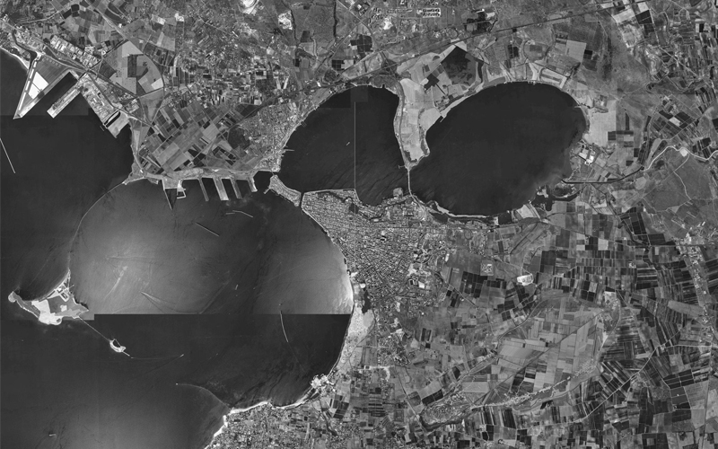
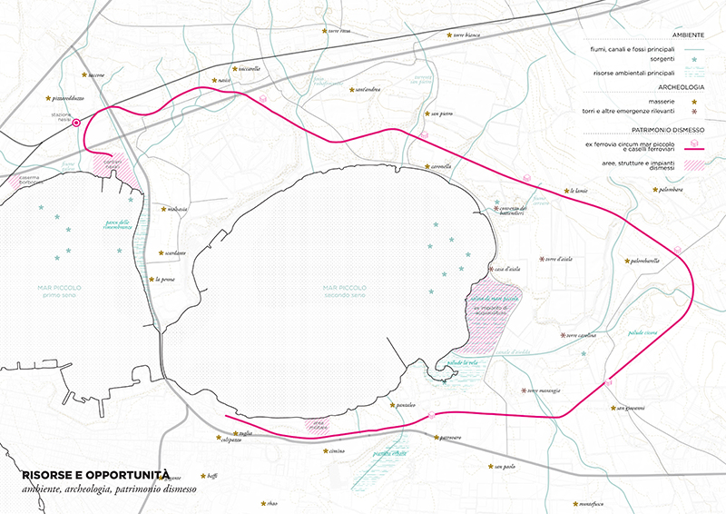
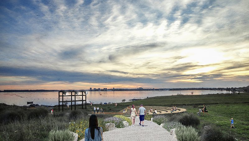
The territorial unit of Mar Piccolo is a naturalistic and archaeological area with a totally unexpressed potential value. This place is unique for its natural conformation (the two seas of Taranto), for the wetland and marine biodiversity that it welcomes despite the state of degradation and pollution, and for the historical and archaeological presence still visible today. The task is to define an innovative and integrated territorial development model that considers the redevelopment of a degraded area as a complex multidisciplinary process, self-sustaining and capable of generating new economies.

Giardini di Falanto is therefore a long-term and broad planning framework, which aims to host different project initiatives, carried out by different subjects, but all directly or indirectly linked to the identity of the areas of Mar Piccolo, to their history and to a few simple guidelines that identify the general rules within the particular processes are included. It is a participatory and shared process to implement sustainable and excellent activities within green and blue economy, social innovation, sustainable mobility, research and technology transfer.

+

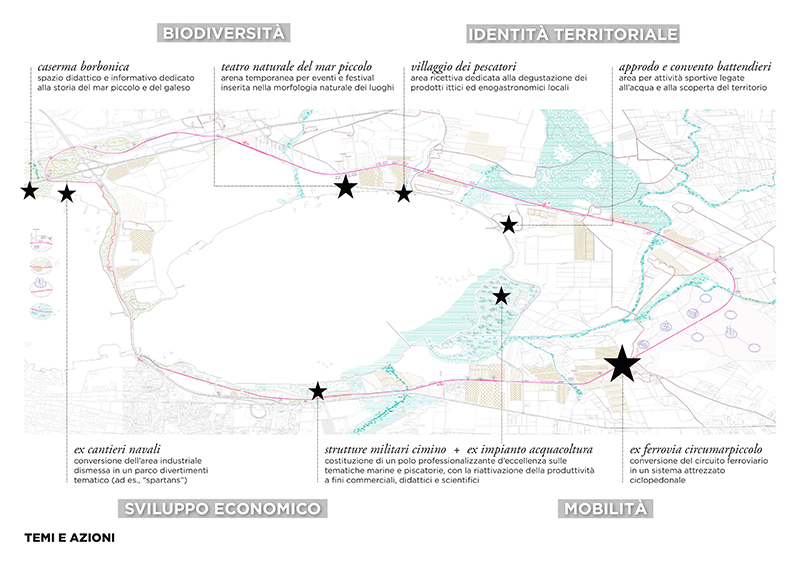
The objective is to build a renewal process starting from the existing, from the available resources of the territory, and working on certain issues (mobility, territorial identity, biodiversity, economic development) that define the guidelines in which the different project actions are then inserted consistently.

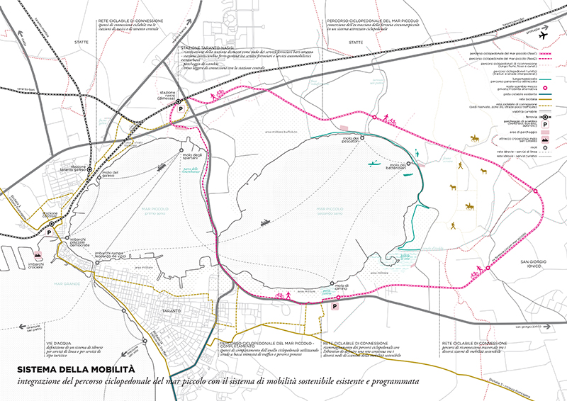
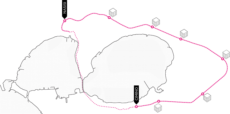
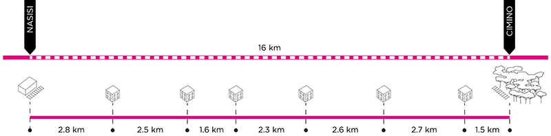
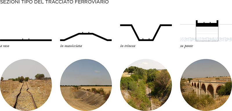
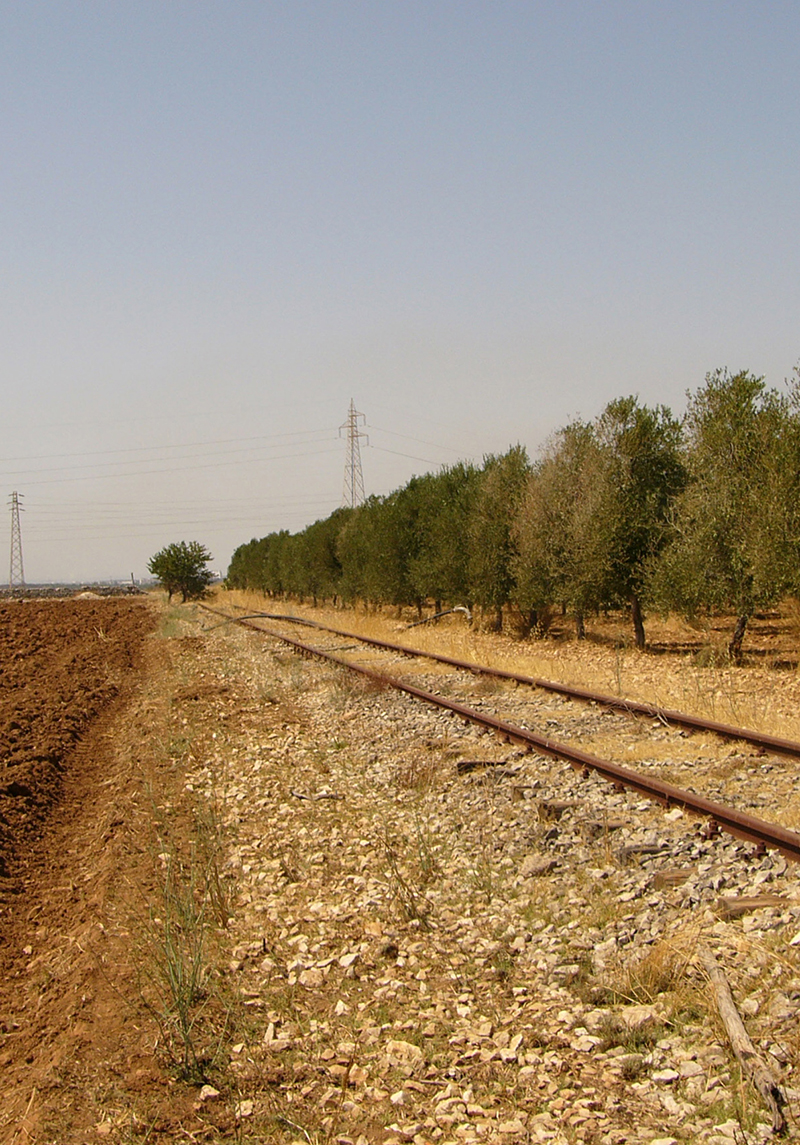
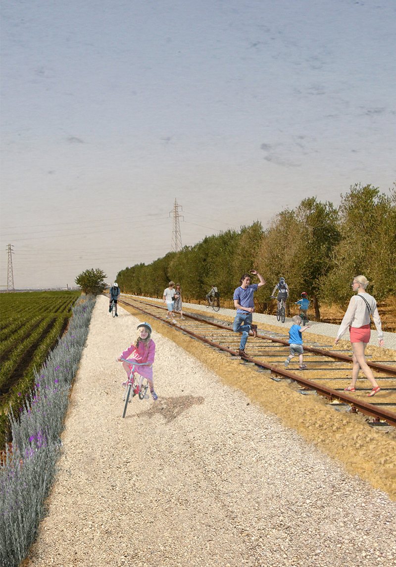
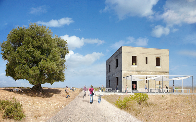
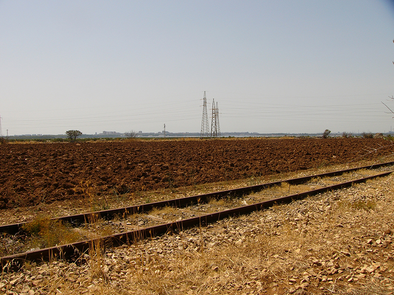
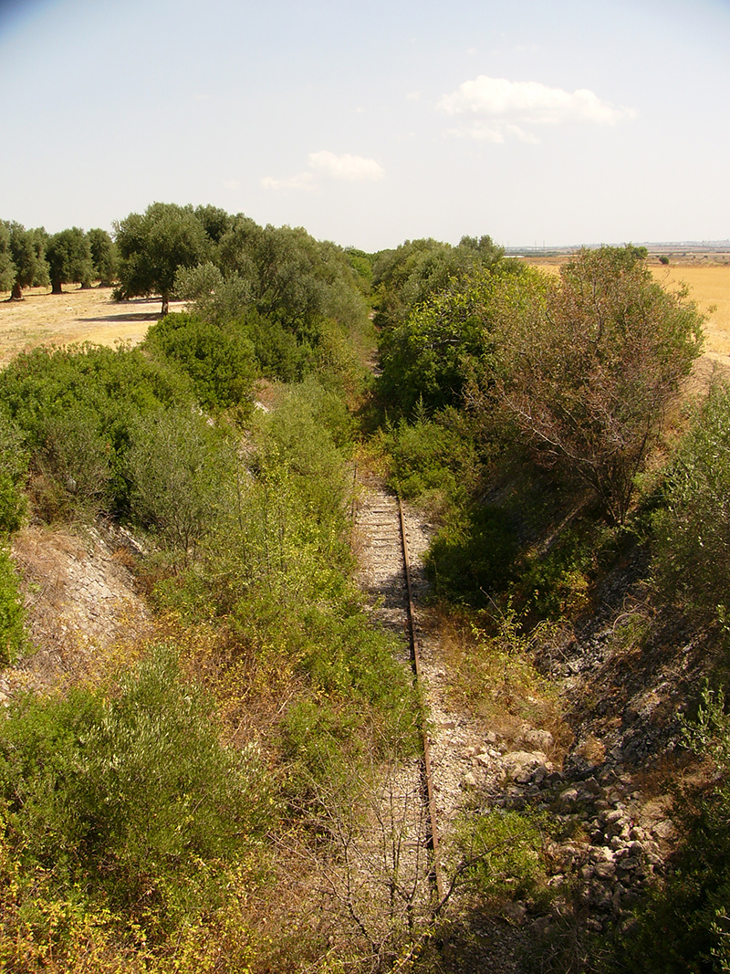
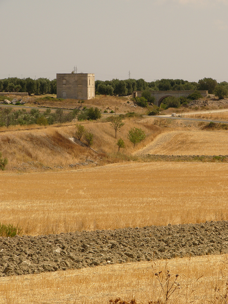
Among these, the starting point for the enhancement of the entire territorial unit is the project to convert the former Circumarpiccolo railway into an equipped cycle and pedestrian path. Once the territory becomes accessible and infrastructured, it can easily return to life, redefining its new role within the city: the infrastructure of the area will be the trigger mechanism capable of stimulating public and private initiatives to start new activities and a network of local economies. The construction of the cycle and pedestrian circuit and the reactivation of the former disused tolls, that can host activities linked to sustainable mobility, tourism and local production, allow the connection of the city and the territory in a continuous, ecological and sustainable way, making it possible to discover and experience the resources and character of the area.

CREDITS

type: research/commission
status: ongoing
client: Ance, Accademia degli Audaci

RIQUALIFICAZIONE DEL CENTRO DI CHAMPOLUC

mobility and new public spaces

RIQUALIFICAZIONE DEL CENTRO DI CHAMPOLUC

mobility and new public spaces | frazione Champoluc, AYAS (AO) | 2016

second phase


#infrastructure #mobility #masterplan #urbandesign

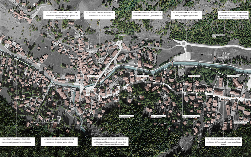
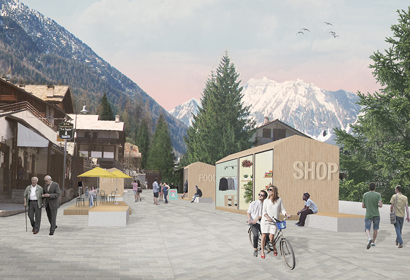
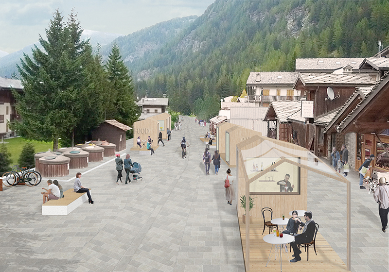
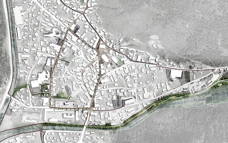
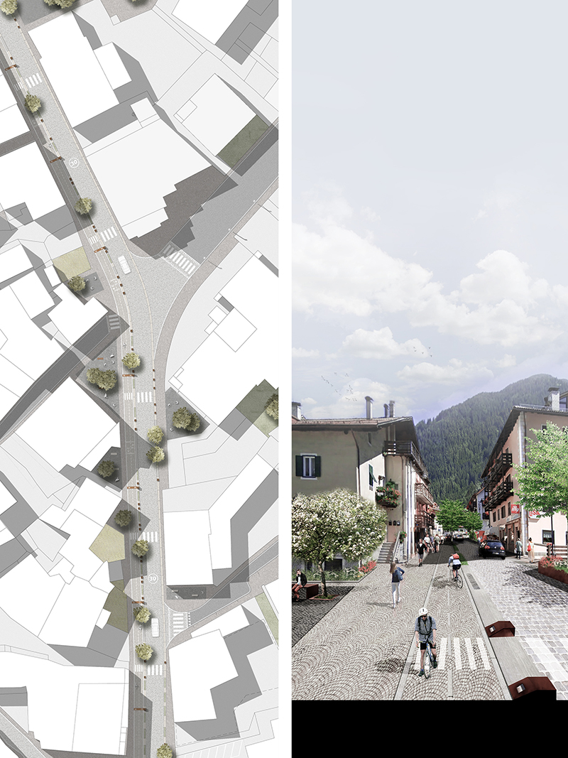
The proposal for Champoluc consists in the definition of an integrated system of vehicular mobility and pedestrian and cycle paths, capable of relating the different functional, morphological and landscape components of the urban system. Through the reorganization of route hierarchies, the networking of attractor nodes in the urban area and the definition of public and aggregation spaces, it will be possible to highlight the qualities of the place and strengthen the touristic, receptive and commercial potential of Champoluc.

+

The interventions are aimed at achieving, in particular, three objectives:

> reducing the crossing mobility from the urban center:the construction of a new by-pass road allows the removal of the crossing traffic from the urban center, which becomes predominantly pedestrian; at the two ends of the town, three exchange parking lots permit to leave private vehicles and proceed towards the center by foot or with sustainable transport systems.

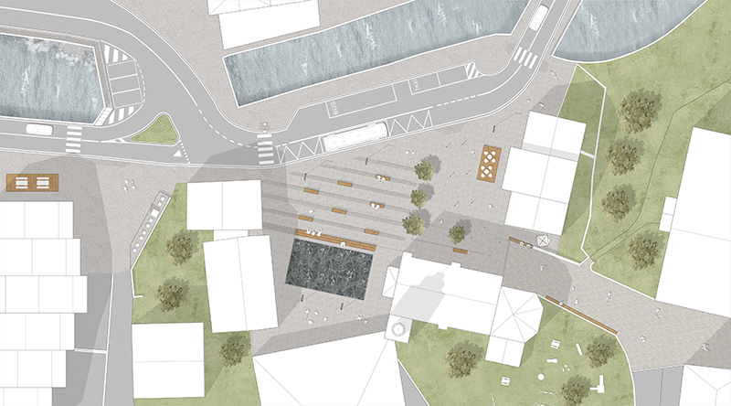
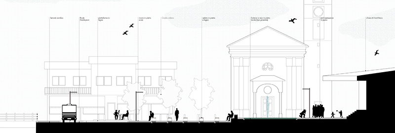
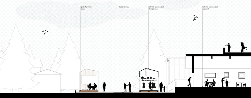
> redefining the system of public spaces and collective areas:the limitation of vehicular entrances in the built-up area allows the configuration of a continuous and protected system of public spaces, with a receptive and commercial vocation; the axis of Route Ramey and the central square become the catalysts for the construction of urban identity.

> make the waterways safe:with targeted operations along the watercourses it is possible to secure the most critical points from flooding, protecting the built-up area and collective spaces.

Through this series of interventions, the identity of Champoluc will be strengthened as a place of excellence in hospitality and in alpine tourism.


CREDITS

type: restricted design competition
result: second phase
client: Municipality of Ayas
with: F&M Ingegneria

PREDAZZO: UNA MARCIA IN PIÚ

bike and pedestrian network

PREDAZZO: UNA MARCIA IN PIÚ

bike and pedestrian network | Predazzo (TN) | 2014

second place


#strategy #bikemobility #pedestrianmobility #publicspace #urbandesign #integratedsystem

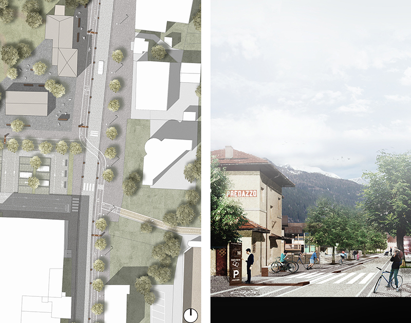
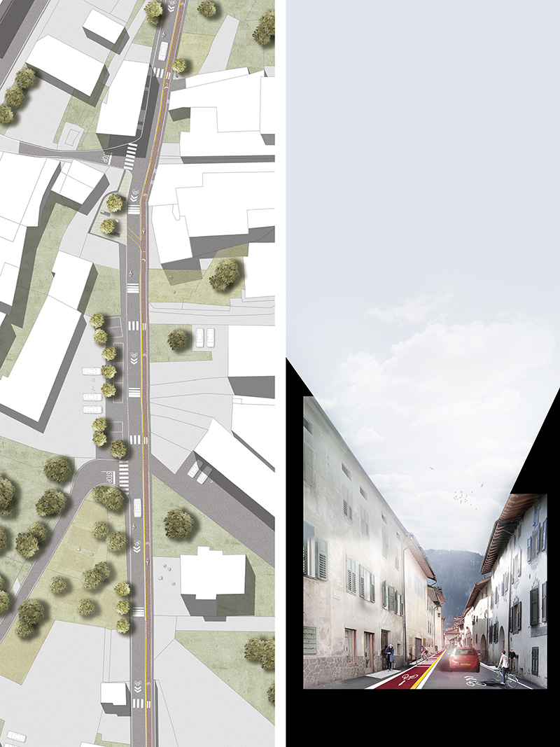
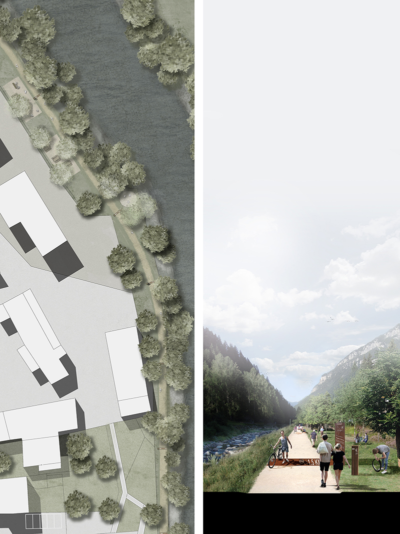
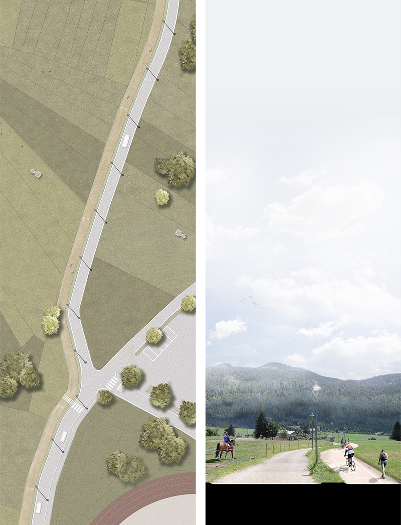
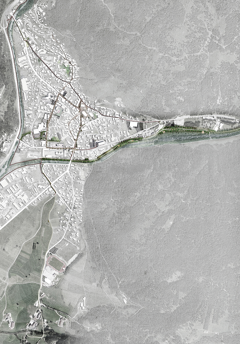
The project proposes to define and communicate a new image for the town: Predazzo as a cyclosystem, a place where pedestrians and cyclists can regain the space that they have lost over time in favor of vehicular traffic, which is instead discouraged and downgraded. A continuous and protected system, which aims to face the new challenges foreseen for the cities of the future: ecology, connectivity, quality of life, sustainability.

+

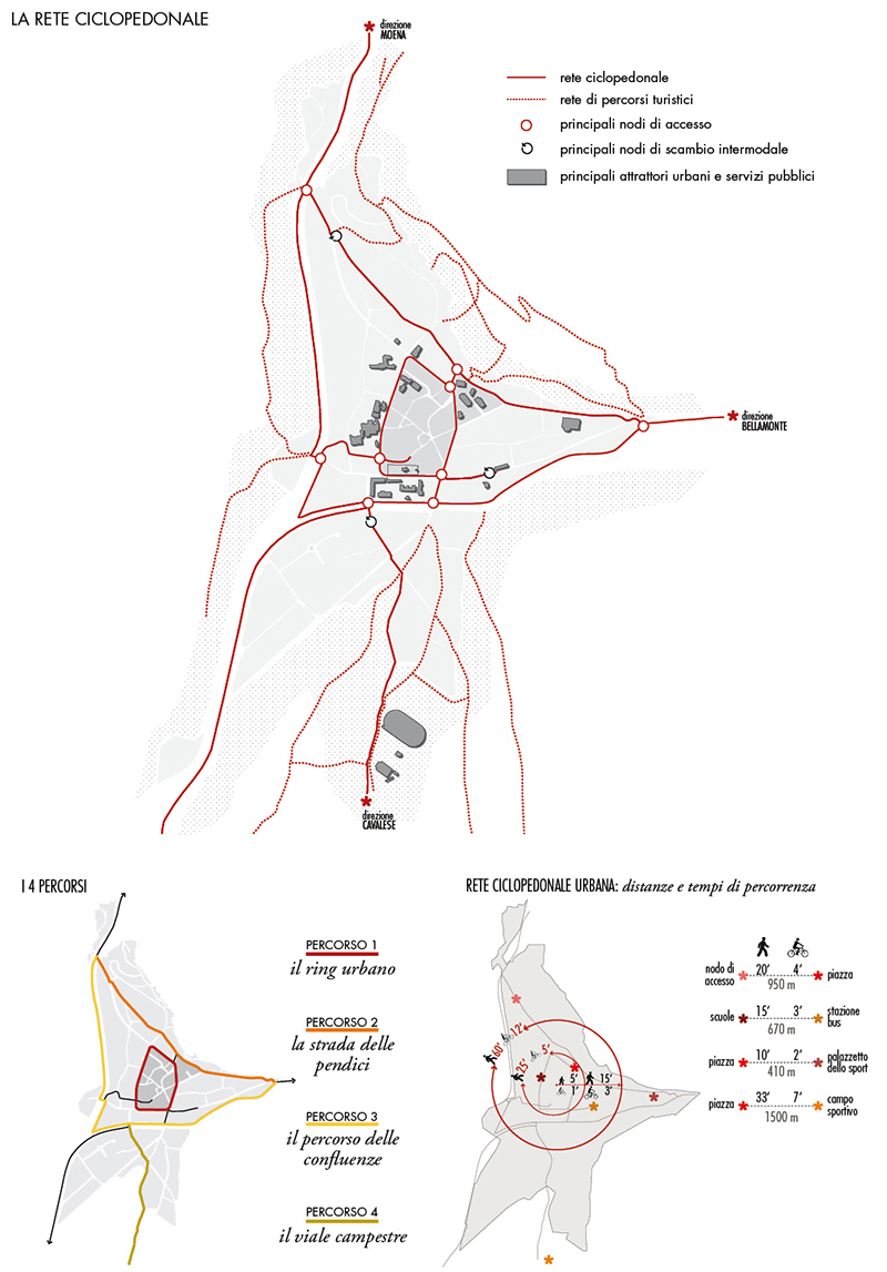
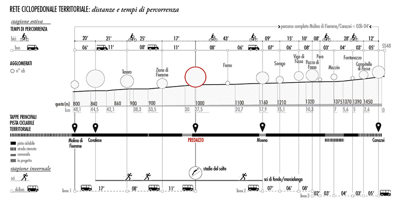
The cyclosystem is a stratified system of cycle and pedestrian mobility, capable of networking, physically and virtually, all the public spaces and attractions of the territory, defining new opportunities and occasions for a sustainable urban development, from a spatial, environmental, economic and social point of view.

The cyclosystem consists of four main routes (il Ring urbano, la Strada delle pendici, il Percoso delle confluenze, il Viale campestre) and their interconnections; each of them has its own specific vocation connected to the context and to the essence of the areas. They are four paths, even though thematic and different for morphology, position, aesthetics and role in the urban economy, that refer to and recall an overall unitary design that allows to rebuild and reinforce the territorial unity.

CREDITS

type: ideas competition
result: second place
client: Comune di Predazzo

LINEAR PARK OF THE ANCIENT VIA COLLATINA

bike and pedestrian route

LINEAR PARK OF THE ANCIENT VIA COLLATINA

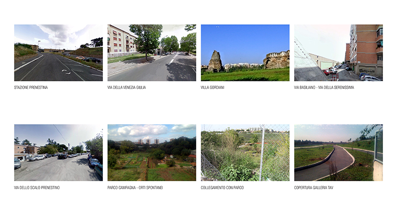
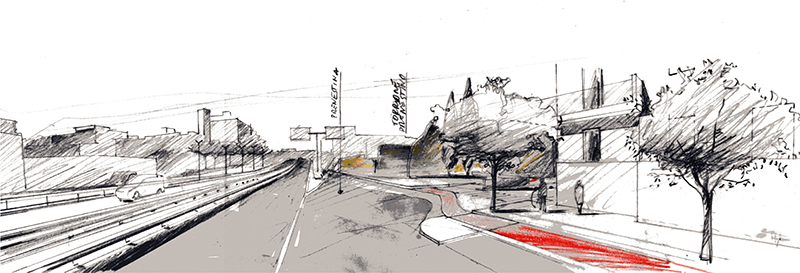
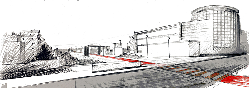
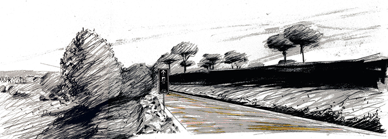
archeological bike and pedestrian route from Porta Maggiore to Gabii | Rome | 2012


#infrastructure #bikemobility #pedestrianmobility #intermodality #urbanregeneration #landscape #territory

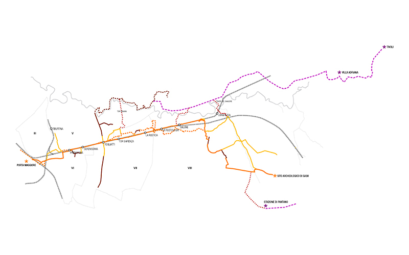
The Porta Maggiore-Gabii equipped cycle and pedestrian path defines an important route towards east in the scenario of the Piano Quadro della Ciclabilità of Rome, along the Rome-Naples TAV track.

The route crosses four municipalities, for more than twenty kilometres, across urban and extra-urban territories and it configures as an infrastructure with more vocations, from daily use along a section heavily congested by traffic, to occasional for playful, sporting and cycling tourism use. In both cases the interconnection (with other routes, with the neighbourhoods, with the main elements) and intermodality between alternative transport systems are an integral part of the study, such as the research of a deep relationship with the history of the crossed places, both at archaeological and landscape level. In the study area there are traceable, in addition to the remains of the ancient city of Gabii, important historical remains still to be investigated, portions of agro romano and environmental and hydrogeological relevant elements.

+

The project therefore presents itself as a sort of great work of linear, urban and landscape redevelopment, consisting of a fundamental structuring path enriched by built elements, arrangement of open space services, redevelopment of areas trough landscape interventions, possibly with public functions, and connections with the urban and territorial context. It will therefore serve to improve the overall quality of the environment for the inhabitants of the crossed context but also to guarantee for the specific users of the path a greater attractiveness of the landscape crossed and a greater security.

CREDITS

type: commission
status: feasibility study
client: Roma Capitale
with: Elisabetta D’Amato, Michele Testa, Roberto Pallottini, Fabio Martellino