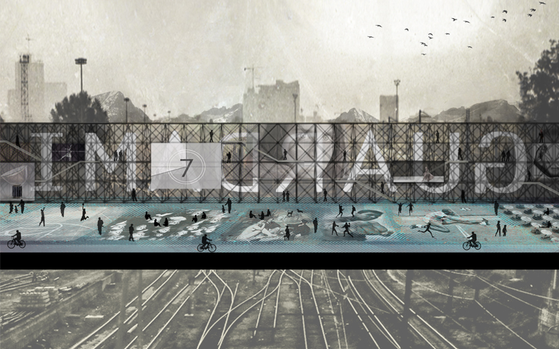
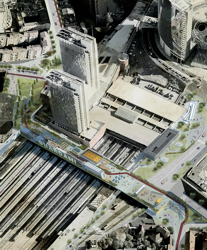
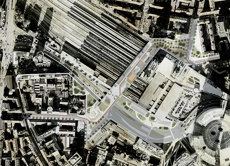
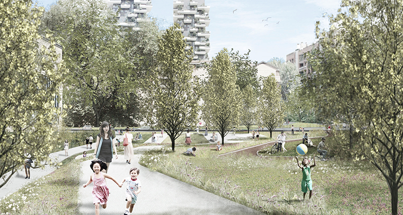
LAUDOMIA

extension of the municipal cemetery

LAUDOMIA

extension of the municipal cemetery | San Pancrazio Salentino (BR) | 2018

special mention


#architecture #landscape #cemetery

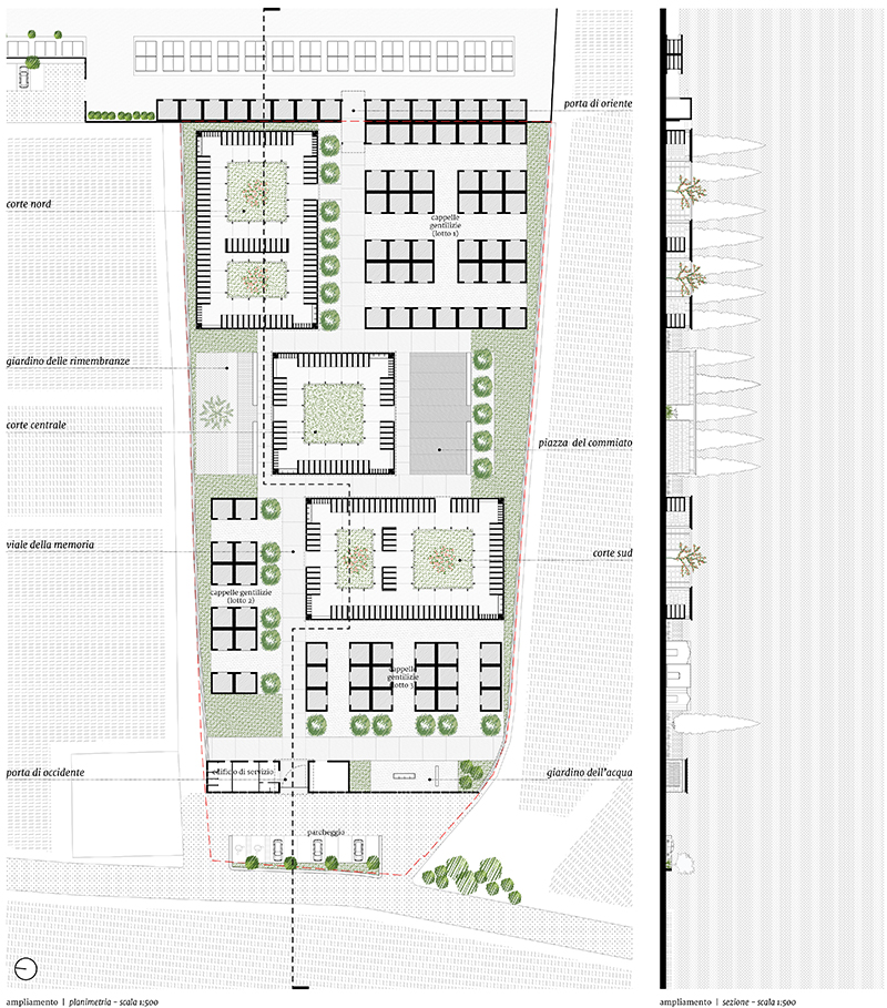
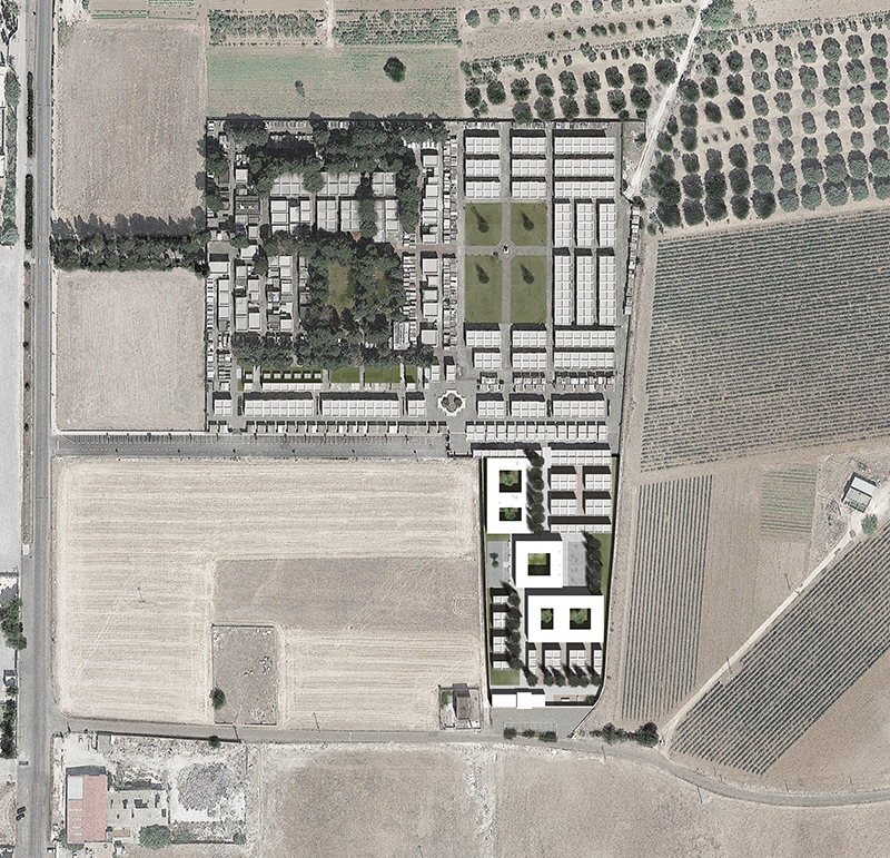
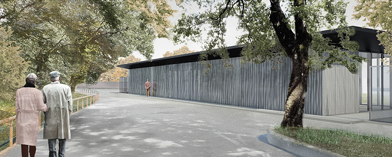
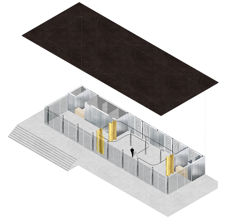
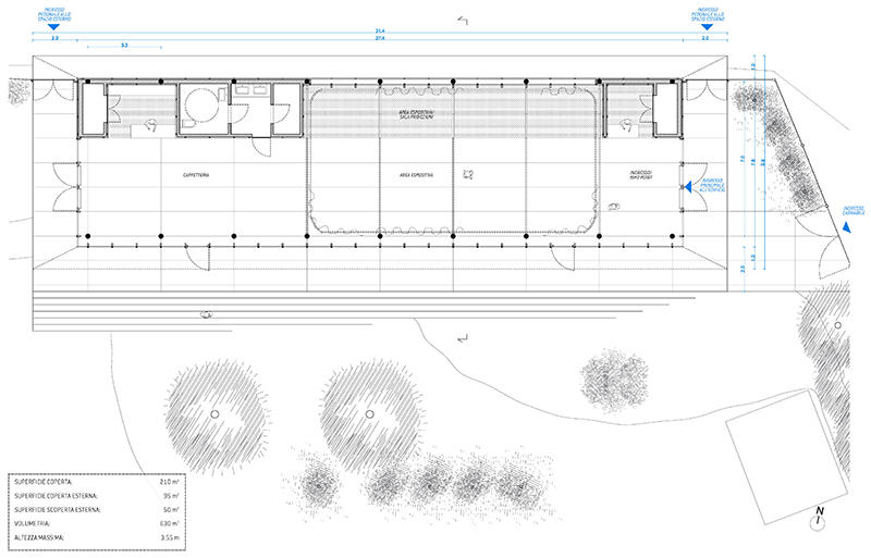
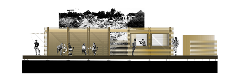
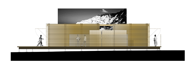
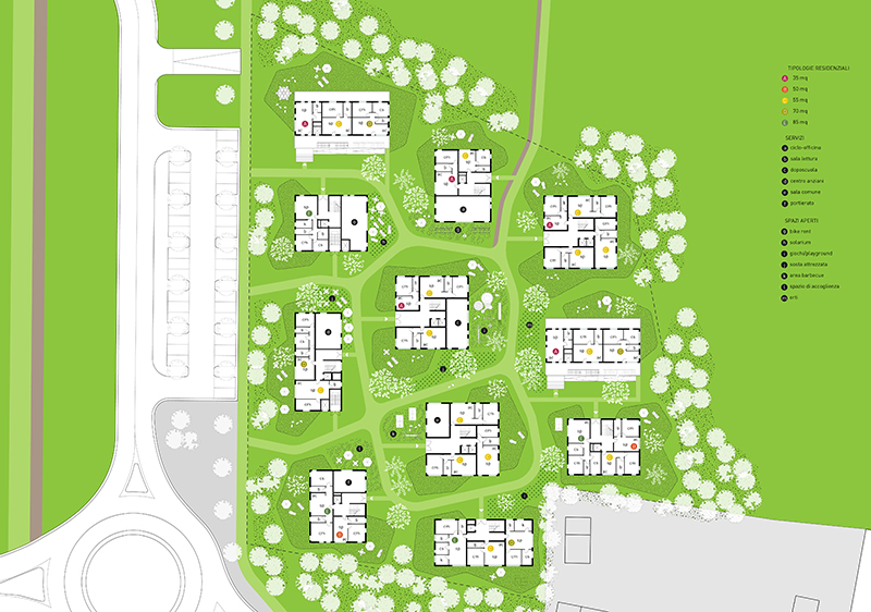
Alla base del progetto di ampliamento del cimitero comunale di San Pancrazio Salentino c’è l’idea di definire una città. Ciò significa organizzare un impianto urbano che si completa nel tempo e che, proprio come la città, è fatto di masse edilizie e di spazi vuoti, di strade, di vicoli e di piazze, di paesaggio naturale e di verde progettato. Questo nuovo impianto, recinto e tessuto secondo una razionale suddivisione in parti gerarchicamente strutturate, ripercorre gli accenti, le ripetizioni, i meccanismi caratteristici della forma urbana. Assi, piazze, slarghi, giardini, stanze, recinti, sepolture individuali e collettive riuniti entro un unico disegno.

+

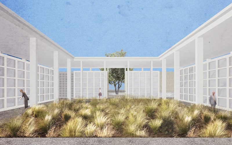
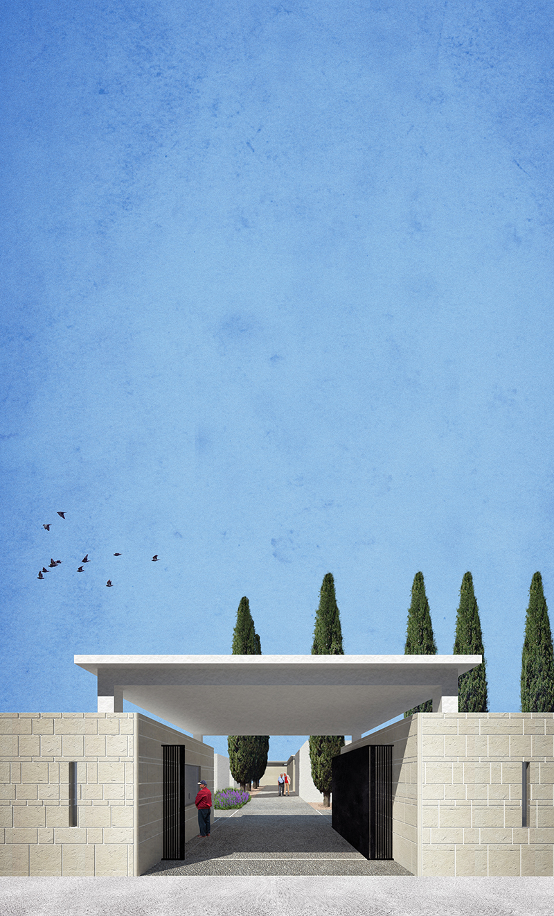
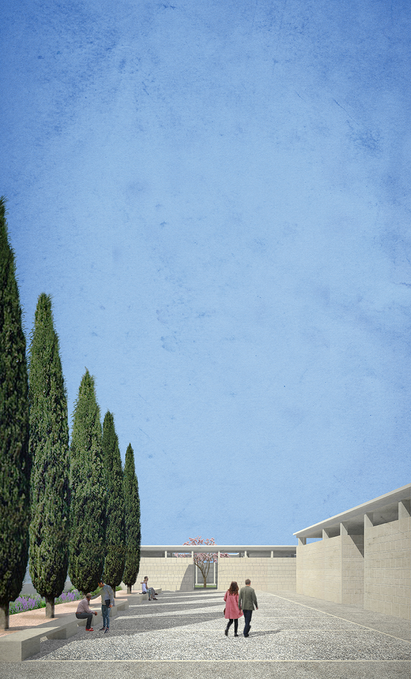
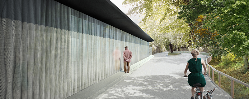
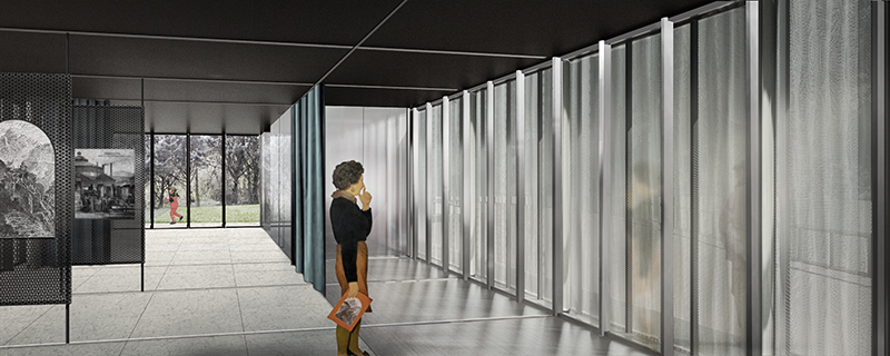
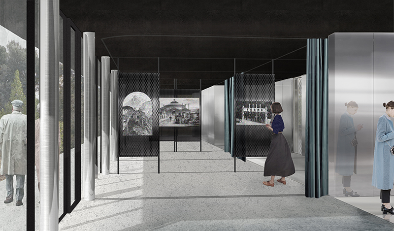
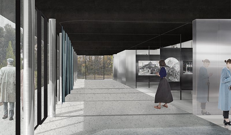
L’impianto è strutturato secondo un sistema ortogonale che si riallaccia a quello del cimitero esistente e che tiene insieme una sequenza di recinti autonomi che alternano sepolture collettive (loculi e ossari) e cappelle private. Camminando lungo il viale principale, guidati dalla linea dei cipressi, si segue un percorso ritmato dalla successione di fatti urbani perfettamente allineati. Il cammino, poi, viene via via interrotto dagli scarti dimensionali e tipologici dei diversi nuclei di sepolture, che obbligano continui cambi di direzione offrendo scorci trasversali e condizioni spaziali differenti.

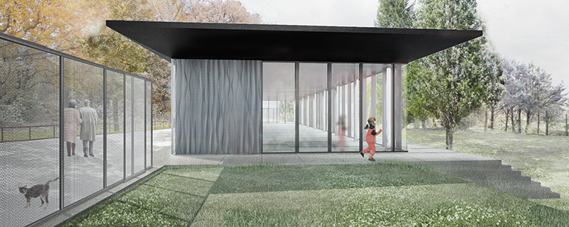
L’obiettivo consiste nell’evitare la monumentalità, l’accrescersi del pathos e il formalismo proprio dell’impianto cimiteriale inteso come monumento, per favorire invece una visione più domestica e quotidiana della città dei morti. Una dimensione umanamente controllabile e pertanto confortante. Dunque le lunghe prospettive si spezzano; la composizione dei pieni e dei vuoti è configurata in maniera tale da obbligare a continui cambi di direzione, a scoprire scorci e inquadramenti sempre diversi, in cui si alternano spazi compressi e spazi ampi, vicoli e piazze, vegetazione geometrizzata e una più irregolare e spontanea.

CREDITS

type: ideas competition
status: special mention
client: Comune di San Pancrazio Salentino (BR)

MUSEO DELLE ACQUE

exhibition pavilion by the lake

MUSEO DELLE ACQUE

exhibition pavilion by the lake | Cascata delle Marmore (TR) | 2017

for AST Acciai Speciali Terni


#pavilion #exhibitionspace #interiordesign #flexibility #landscape #steel #garden #museum

The project consists in the design of a multi-purpose pavilion to be inserted in the landscape of the Cascate delle Marmore and the arrangement of the garden overlooking the lake.

The exhibition space shows the history and functioning of the fascinating hydraulic engineering system that regulates the water supply of the Terni steelworks, of which the Cascate delle Marmore is the most spectacular element.

+

The pavilion is composed by a flat covering supported by slight cylindrical pillars. The space below is enclosed by a glass case that houses a reception area, a flexible multifunctional space, a cafeteria and the services.

The relationship with the surrounding landscape is regulated through the use of vertical surfaces characterized by different materials and textures. Micro-perforated steel panels shield the façade towards the street allowing light to pass through, while a system of curtains organizes and shades the interior space.

The choice of the materials is based on the production of steelworks. The building in fact foresees the use of stainless steel in various forms: from the structures, to the external cladding panels, perforated and corrugated, to the internal panels steel brushed and mirrored, to the exhibition panels.

CREDITS

type: commission
status: preliminary project
client: AST Acciai Speciali Terni
structures: eng. Michele Pierini

GUARDA-MI

redevelopment of the Cavalcavia Bussa

GUARDA-MI

redevelopment of the Cavalcavia Bussa | Milano | 2014

winner – in progress


#publicspace #infrastruttucture #bikemobility #urbanregeneration #urbandesign #multiplieuse #temporary #flexibility #playground #sportfacilities

GUARDA-MI is the redevelopment project of the Bussa Overpass and it’s connections to the city in a continuous system of public and green spaces.

GUARDA-MI consists in an operating strategy that can transform a space that has lost its urban function in an extra-space, a living and lived space, returning it to the city. The transformation project will be progressively included in the collective imagination of the urban landscape as a place where, assuming a certain amount of responsibility, it will be possible to lay the foundations for alternative models of development based on temporary uses and adaptability, on the interaction between the urban actors that are involved at diff erent levels in the processes of transformation and on the direct involvement of users.

+

The redevelopment of the overpass is designed to create a place with its own identity, yet changing and constantly evolving: a clearly defi ned space but where everything is still possible. For this reason the overpass and the two head points have been “infrastructured” according to a few general rules that include an open process with wide margins of adaptability (both regarding the market request and the constant changes of demand) and that ensure, in each moment of the urban life cycle of the intervention, a correspondence to the overall image of the proposed project.

CREDITS

type: restricted design competition
result: winner/ongoing
client: Comune di Milano
with: Guglielmo Bartocci, Elisa Borgognoni, Agnese Monica, Giovanna Perdichizzi
model: Modelab


WHITE GARDEN

pavilion on the beach of Scala dei Turchi

WHITE GARDEN

pavilion on the beach of Scala dei Turchi | Realmonte (AG) | 2014


#landscape #pavilion #exhibitionspace #shade

The aim of the intervention is to improve the use of the Scala dei Turchi natural protected area. The project involves the realization of new accesses to the beach and a pavilion to host services aimed at tourist accommodation.

+

The natural landscape of this stretch of coast is characterized by a sloping orography, defined by a system of natural terraces. One of the main purpose of the project is to allow accessibility and safety for the public while respecting the nature of the place. A system of walkways and paths bring the visitor to the beach through a garden dedicated to the Mediterranean landscape.

A horizontal roof covers the three volumes that host the various functions, info-point for tourists, small exhibition spaces, refreshment point / bar and toilets for the public.

The supporting structure of the pavilion is designed with modular elements made of wood and steel, which allow easy assembly and flexibility in configuration.

The external cladding is conceived in wooden panels consisting of a weft of slats with different spacing between the elements. The aim is to obtain a direct and suggestive relationship with natural light and shadows during the day and allow artificial light to filter out during the evening hours.

CREDITS

type: commission
status: feasibility study
client: private
with: Raffaele Patitucci

OPEN BLOCK

new housing settlement

OPEN BLOCK

new housing settlement in the PII Cascina Merlata | AAA architetti cercasi | Milano | 2010

special mention


#housing #newurbanity #community

The proposal is to structure the intervention as a city block in the countryside and consists of several buildings, with the aim of establishing an integrated system of voids inside. The project is essentially a part of the city where the different elements, placed side by side, generating in turn, views, streets, plazas and squares in continuity with the natural spaces that surround the area.

+

The different building types have been designed to accommodate the largest possible number of different housing types, in order to meet the diverse needs and desires of the community. The goal of this project is to create a precise relationship between solid and void, between building type and characteristics of the open space: public, semi-public and private. The project proposes an intervention where buildings, occupying only 25% of the surface area, leaving the ground free paths, gardens and common areas, gardens, playground and private gardens on the ground floors of residences. These strategies ensure that the entire project to appear as a part of the city, where the variety and the alternation of spaces, materials and colors, they return in the immediate idea of ​​urban complexity.

CREDITS

typ: ideas competition
risultato: special mention
client: Confcooperative, Legacoop, Euromilano
with: 2A+P/A, Tommaso Arcangioli

CIVITA CITTÀ SOSPESA

renewal of the town access walkway

CIVITA CITTÀ SOSPESA

renewal of the town access walkway | Civita di Bagnoregio (VT) | 2008

special mention


#pedestrianmobility #intermodality #accesibility #landscape

Civita di Bagnoregio è una città sospesa. Sospesa nello spazio, dove sembra fluttuare solitaria al di sopra del “mare increspato dei calanchi”, e sospesa nel tempo, che inesorabilmente erode le sue rocce e con esse la certezza della sua esistenza. Solida, resistente e tenace, e al contempo fragile, friabile e instabile, l’immagine di Civita esprime con forza il precario equilibrio tra elementi contrastanti, che è la chiave di lettura del carattere straordinario di questi luoghi.

+

La sfida del progetto è quella di trovare un linguaggio capace di confrontarsi in maniera forte con il paesaggio, ma senza prevaricare i delicati rapporti costruiti nel tempo dall’uomo per abitare la natura, ridefinendo la contestualizzazione del ponte nel territorio, così come le soluzioni di accessibilità nell’attacco a Bagnoregio, con i parcheggi e servizi per i visitatori, e nell’arrivo a Civita, con il nuovo sistema di risalita meccanizzato.Pertanto il progetto del nuovo sistema di collegamento tra Bagnoregio e Civita trae origine da due scelte fondamentali che rispondono all’esigenza di coniugare le difficoltà tecniche con le possibilità espressive: innanzitutto si è stabilito di abbattere il vecchio ponte, conservando però i plinti di fondazione come punti di appoggio della nuova struttura, e in secondo luogo si è scelto di restituire l’unità formale della connessione disegnando il ponte attraverso una linea continua e diretta. Dunque la geometria del ponte si costituisce nella composizione planimetrica di due linee: una curva che si sovrappone alla spezzata disegnata dai plinti originari, ed una retta che traccia un collegamento diretto col borgo. Nello spazio queste linee giacciono su un piano curvato che disegna una traiettoria morbida che stabilisce una relazione chiara con l’andamento del terreno. Il ponte diventa così quell’anello mancante nel paesaggio capace di restituire simbolicamente e percettivamente il significato di Civita città sospesa nello spazio e nel tempo.

CREDITS

type: ideas competition
result: special mention
client: Comune di Bagnoregio
with: Amelia Blundo, Davide Sacconi, Stefano Villani